Faroe Islands: Week 2

After an unusually sunny first week in the Faroe Islands, my remaining time exhibited the more typical Faroese pattern of unpredictable rain, fog, and wind. This wasn’t nearly as bad as it seems though, since the weather is rarely the same everywhere and the country is small enough to drive across (and back) in a single day. I had a rental car starting Monday, so I could adapt my plans and chase the sun by checking webcams distributed around the country.

Being able to drive also meant I could check out Eysturoyartunnilin, the last subsea tunnel I hadn’t seen, with the world’s only subsea roundabout. The Faroese are incredibly prolific at building tunnels, and not only the subsea variety. When I was there in 2018, the tunnels in the Northern Isles were single-lane and unlit. But in 2024, they replaced them with modern two-lane tunnels that allow larger vehicles to pass. They even opened a new tunnel while I was visiting! On Sandoy — coincidentally on the same day that I visited, but on the other side of the island — the tunnel connecting Dalur and Húsavík was opened, letting residents avoid the narrow cliff-side route that has a history of landslides.
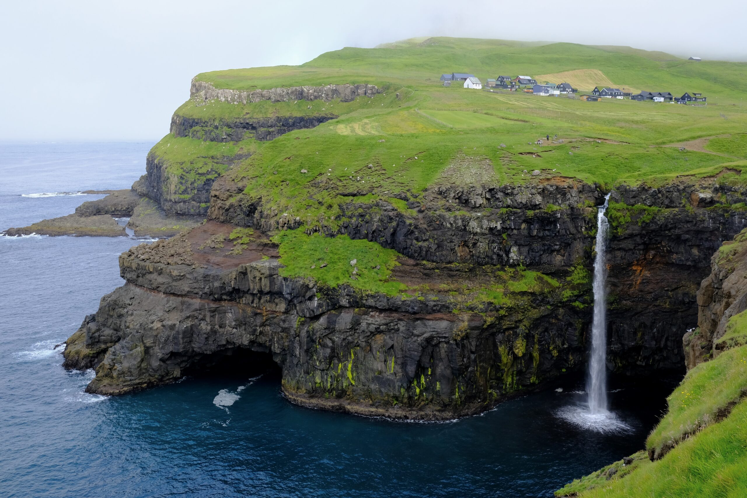
Múlafossur waterfall in Gásadalur.

On Monday, my initial plan was to hike the old postman route between Bøur and Gásadalur on the island of Vágar. Gásadalur is most well known for the Múlafossur waterfall, whose water falls from the cliff edge into the ocean. But I’ve long been interested in the history of the village itself, which was very isolated before the tunnel was built twenty years ago. There is a fascinating documentary called 1700 Meters from the Future, which I’ve written about (and you can watch) on my Looking North blog, that was filmed in the time period just before the tunnel. It shows what life was like there, and touches upon the hopes and fears that the impending tunnel raised for the 17 residents at the time.

The mountain path I wanted to hike is the one the village’s postman would historically walk every day, and continued to walk three times a week even after helicopter service started in 1983. The film features the second-generation mail carrier, whose father before him walked the route for 56 years. It’s stories like these that fascinate me about remote places like Gásadalur, and I was excited to experience for myself what that route was like. Unfortunately, on Monday morning, the top of the mountain sat in a cloud of fog. Buoyed by my experience on Stóra Dímun the previous week, where the fog ended up clearing just in time, I began the route undeterred. But after a mile and a half of very vertical walking, the fog was thick enough to soak my hair, and the wet grass underneath my feet was slippery. I was alone, the views of Tindhólmur and Drangarnir were lost to the fog, and I concluded that I should turn around.

I had planned for other hikes on Vágar, but the fog seemed intent on hovering, so I decided to visit the village of Tjørnuvík on Streymoy, which had clearer skies. The road to Tjørnuvík reminded me of traveling in the Westfjords, or the north of Iceland. The end of the road gets progressively narrower, eventually dropping to a single lane serving two directions of traffic. This isn’t necessarily unusual in the Faroe Islands; cars simply negotiate their turn, using pullouts placed at regular intervals. But the final stretch, where the road descends along the cliff edge into the village, is gated by a traffic light that alternates for each direction at five-minute intervals. There are many signs along that way, forbidding cars from stopping, which is understandable because the view as you round the corner of the mountain is incredibly photo-worthy.
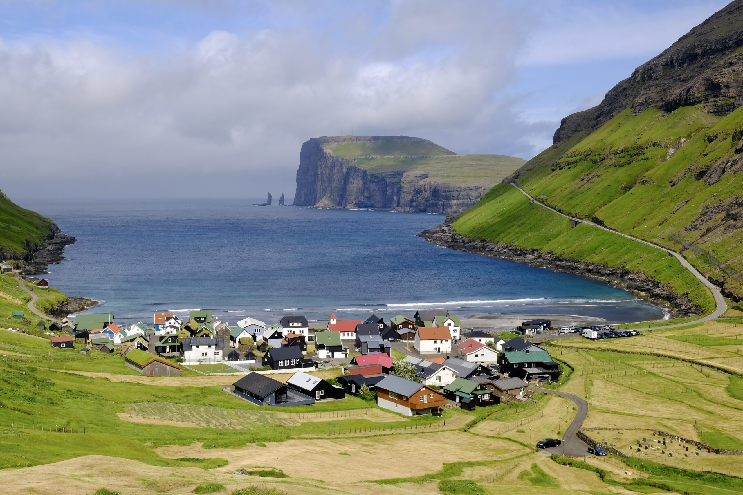
The village of Tjørnuvík.

Tjørnuvík is home to the best surfing beach in the Faroe Islands, the best view of the sea stacks known as “the Giant and the Witch,” and, relevant to my unique interests, is also the landing site for the CANTAT-3 subsea fiber-optic cable. That cable is pretty old and slow now, largely used as a backup connection, but it marked the first time the Faroes were directly connected to North America when it went live in 1994. Not surprisingly, this was not an attraction for anyone else, but the cable connection box is right there on the beach itself, ready for a prominent plaque to mark this milestone of telecommunication history, if someone were so inclined.
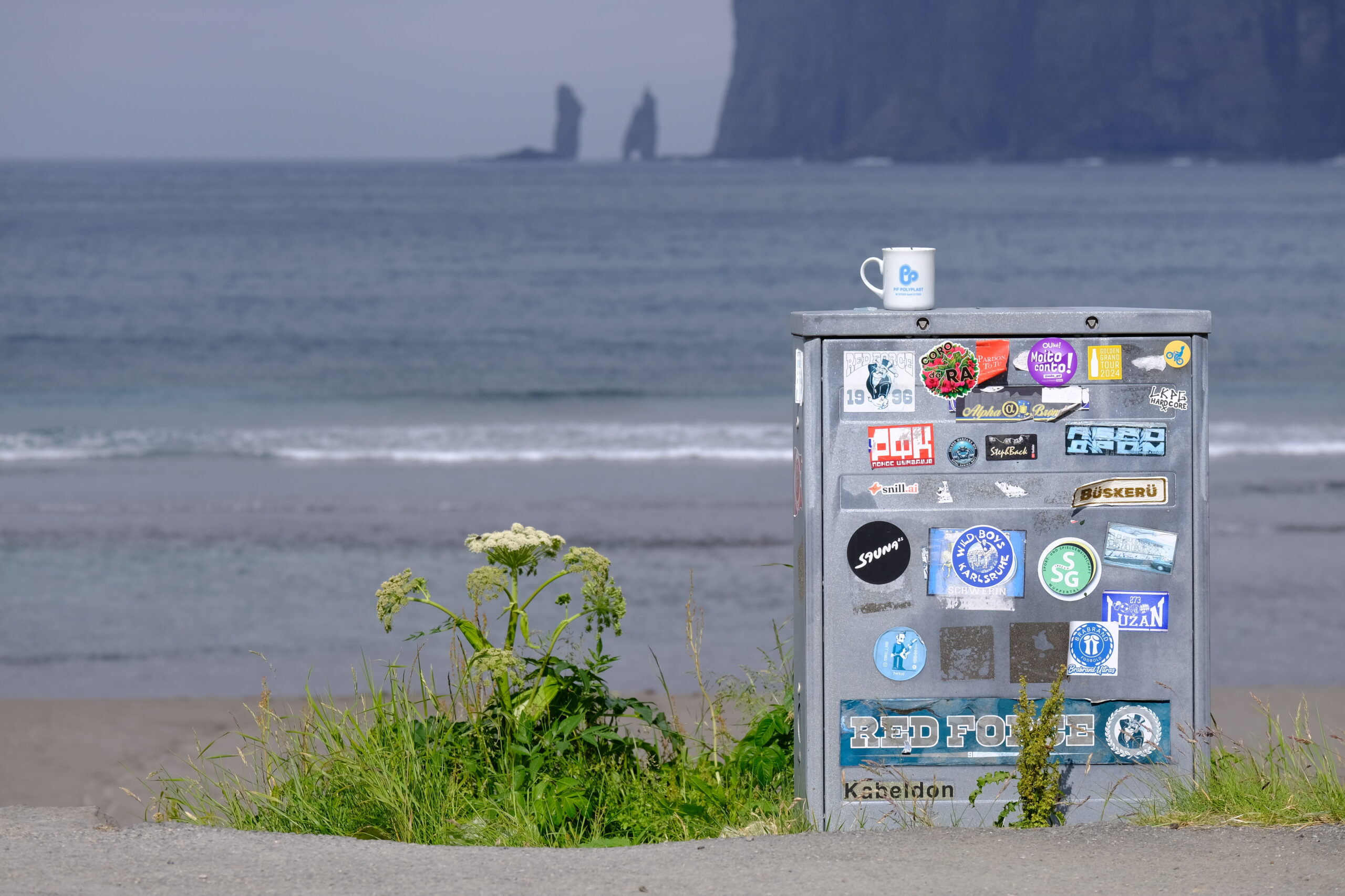
I believe that this is the cable connection point for the CANTAT-3 subsea fiber-optic cable. I couldn’t find any other evidence, and I know that it is located in Tjørnuvík.

Tuesday, I drove to the Northern Isles, one of the most dramatic areas in the Faroes, to catch a morning ferry to Kalsoy. This island is long and skinny, earning it the nickname of “the flute” for the combination of its shape and the series of tunnels that make up the single road along the east side of the island. These are old-school mountain tunnels, the kind that have been mostly upgraded on the other islands, just barely big enough for the bus to fit through.

I was headed to the northern tip of the island to hike to the Kallur Lighthouse. That hike has gotten more popular recently, since it was used as a filming location in the James Bond film No Time to Die. On this day, the island exhibited the kind of micro-climates that the dramatic topography of the Northern Isles is particularly known for. Most of the fog was moving fast, hiding and showing views of Kunoy, which runs parallel to the island, in the span of a minute or less.
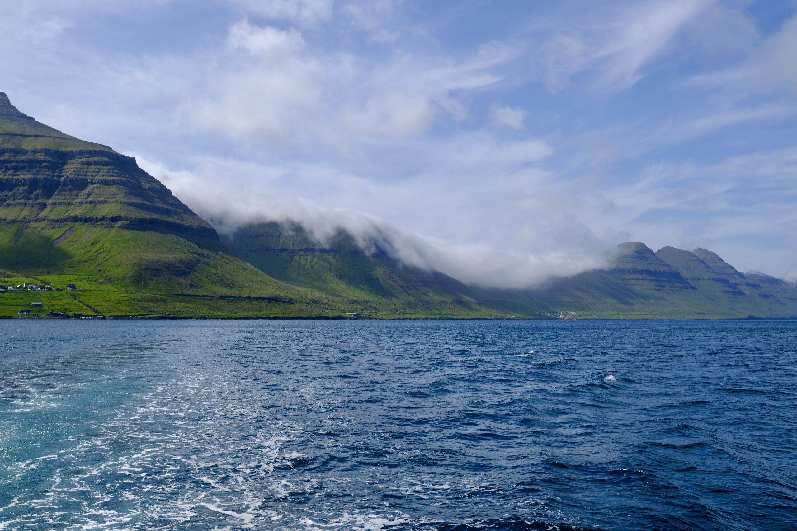
Kalsoy as viewed from the ferry.
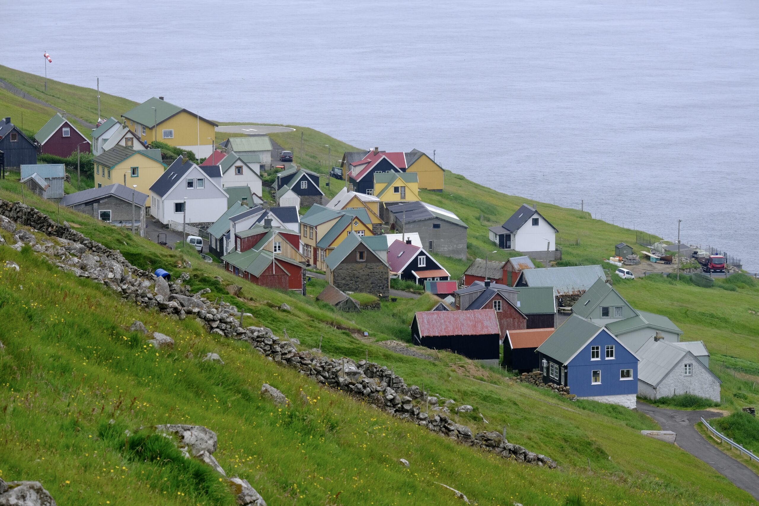
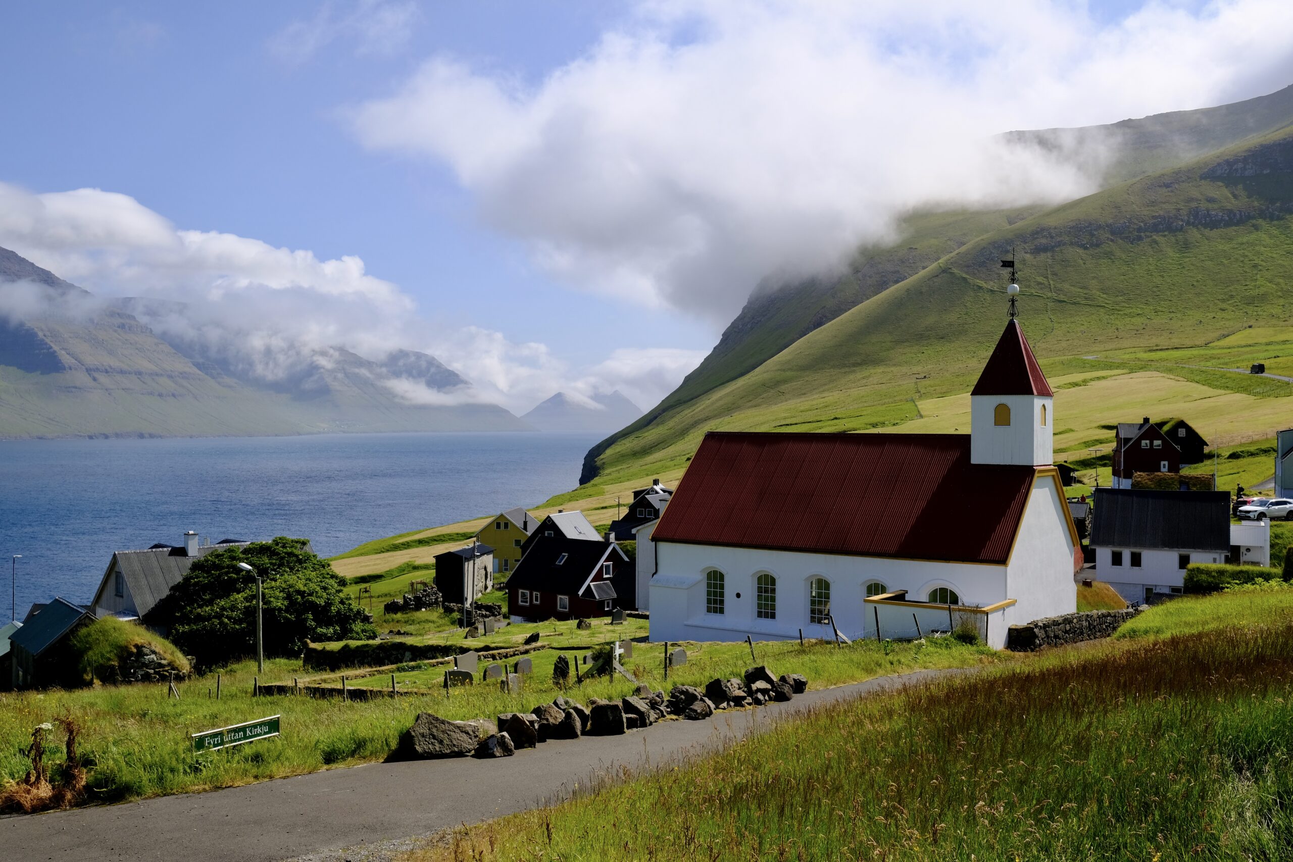
The village of Mikladalur on Kalsoy.
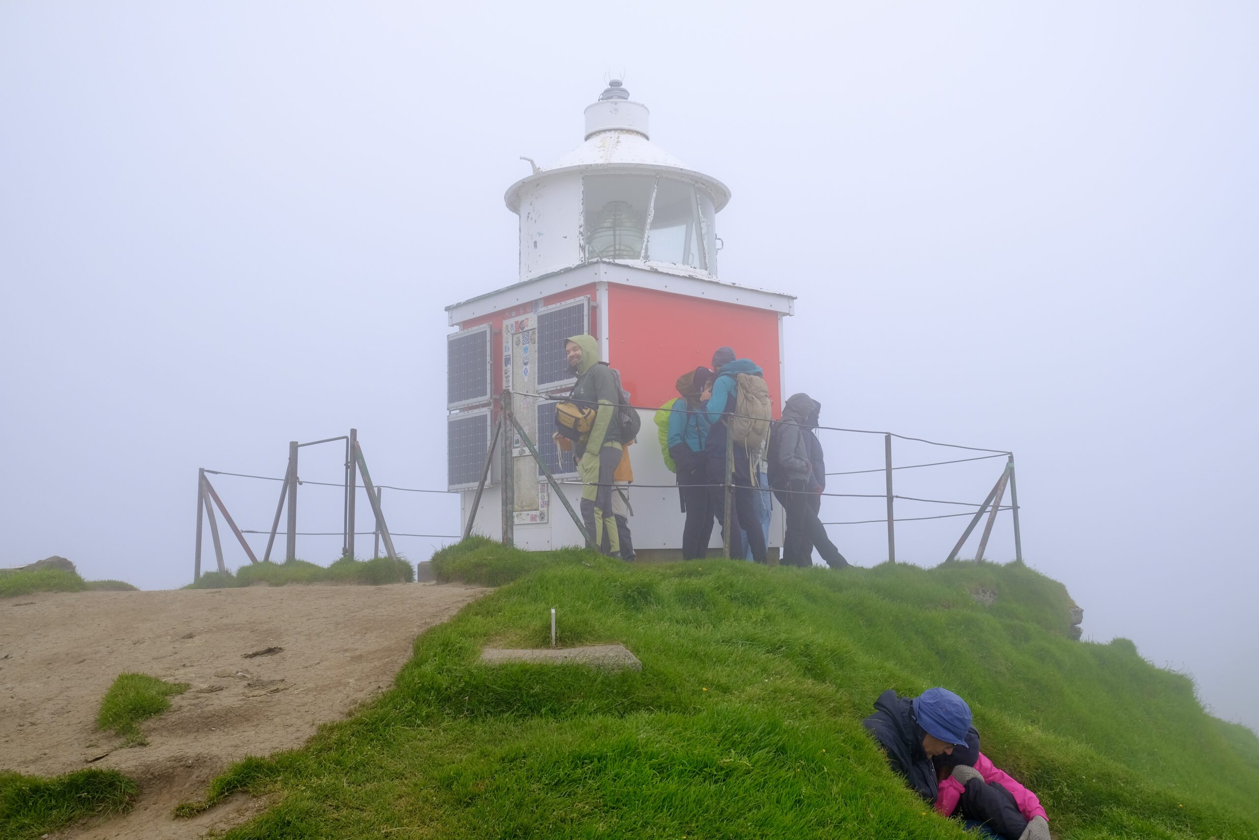
There was no view from the lighthouse, and the wind picked up enough that people were sheltering in the sheep dugouts.

Wednesday, I was back in the Northern Isles, for a day of somewhat extreme logistical complexity with the goal of traveling to the island of Fugloy and taking a helicopter ride. The helicopters operate as public transit, serving outlying islands. Non-residents can use them, but at an increased cost, and you can only book a one-way ticket. My day involved driving to Klaksvík, then taking a bus to Hvannasund to catch the ferry to Hattarvík on Fugloy. From there, I walked over the mountain road to Kirkja, the other village, where I took a helicopter back to Klaksvík. I could have stopped there, but I didn’t. Instead, I waited for the helicopter to refuel and flew to Tórshavn, where I walked to the terminal and caught a bus back to Klaksvík, then drove back to Tórshavn. Yes, it was worth it.

Fugloy is a place I’ve wanted to visit for a long time. Back in 2019, I wrote about a documentary made about Hattarvík in 2001 that talks about life there at that time. It questions what will become of the village, but also points towards the potential for mobile phones and the Internet to revive the remote community. Hattarvík, the easternmost settlement in the country, still has a very small population. Yet because of the Internet, I actually know someone who lives there. She contacted me because of that blog post, to tell me that she was marrying one of the men in the film and moving to Fugloy to live with him. She posts about her life there now as @FugloyFarm on Instagram, and while she wasn’t there when I visited, she was kind enough to take a phone call when I was planning my trip and encouraged me to take the helicopter.
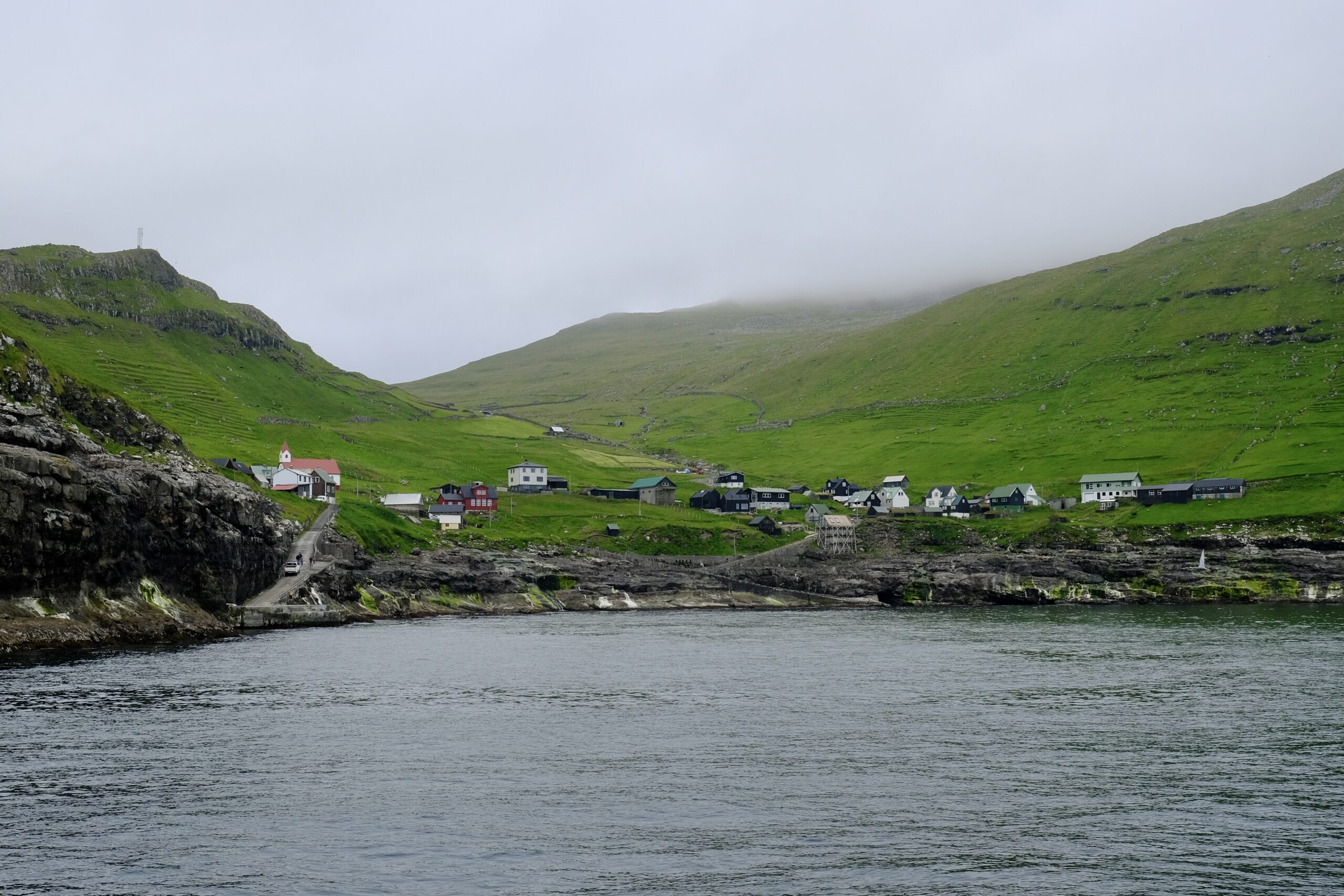
Hattarvík from the ferry.
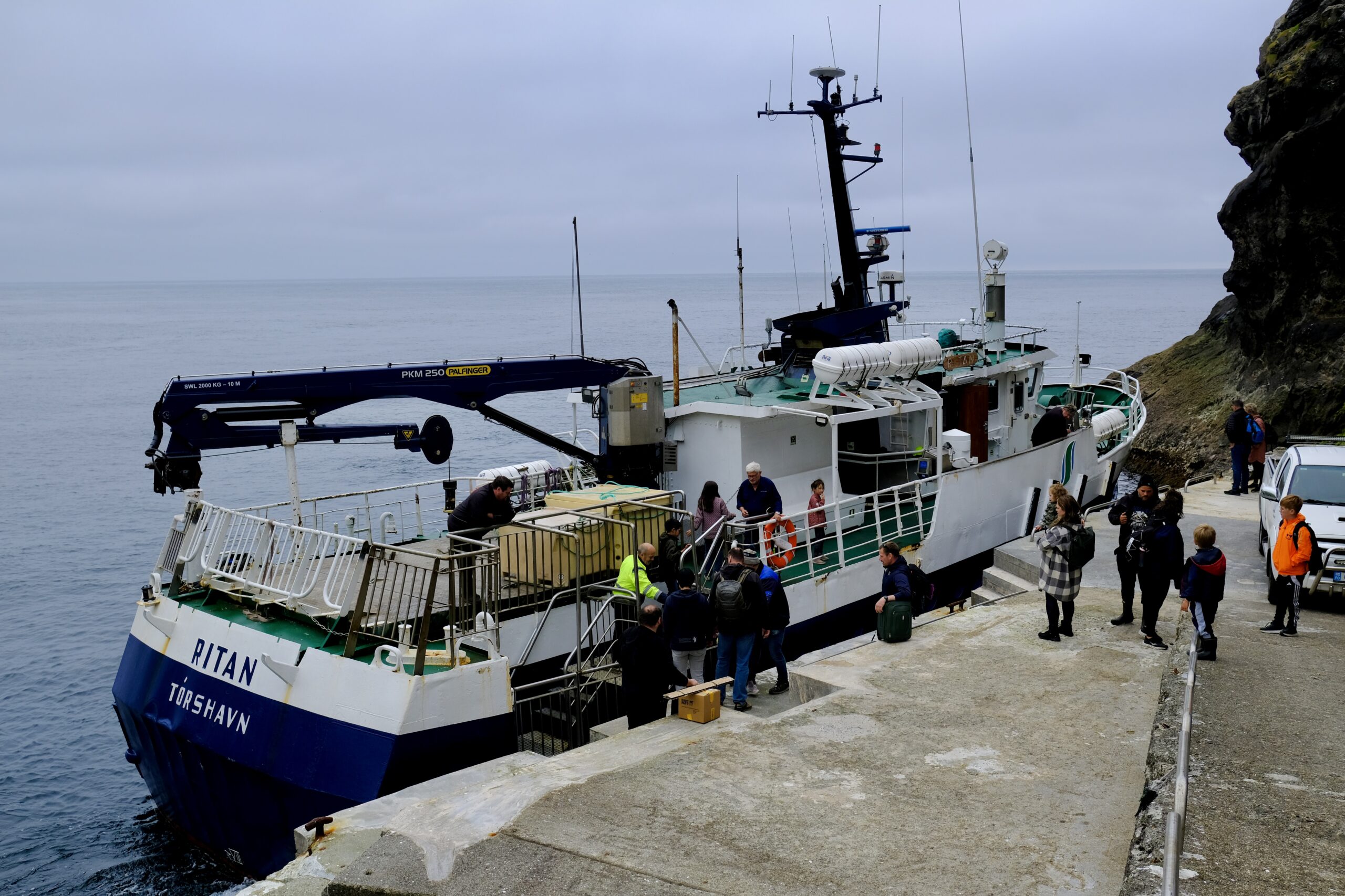
The ferry, docked at Hattarvík.
Kirkja, on Fugloy.

Similar to my other hikes during the week, the walk between villages was through the fog, so I missed out on views of Svínoy, Borðoy, and Viðoy from the top. But as I descended to Kirkja, I was happy to see that the fog was clear enough at that level for the helicopter to fly in, and I would soon be seeing those islands from above.

As the helicopter arrived, it seemed to draw the entire population of the village to the landing pad, both passengers and onlookers. The loading process was very informal, typical for the Faroe Islands, and while nearly every seat was filled, I was lucky to get a window seat for each flight. In the air, the reaction of the locals was muted, treating it like the public transport it was, but I couldn’t wipe the smile off my face. It was stunning to see a swath of the country from the air, particularly the Northern Isles. You can watch videos from the flight on Instagram.
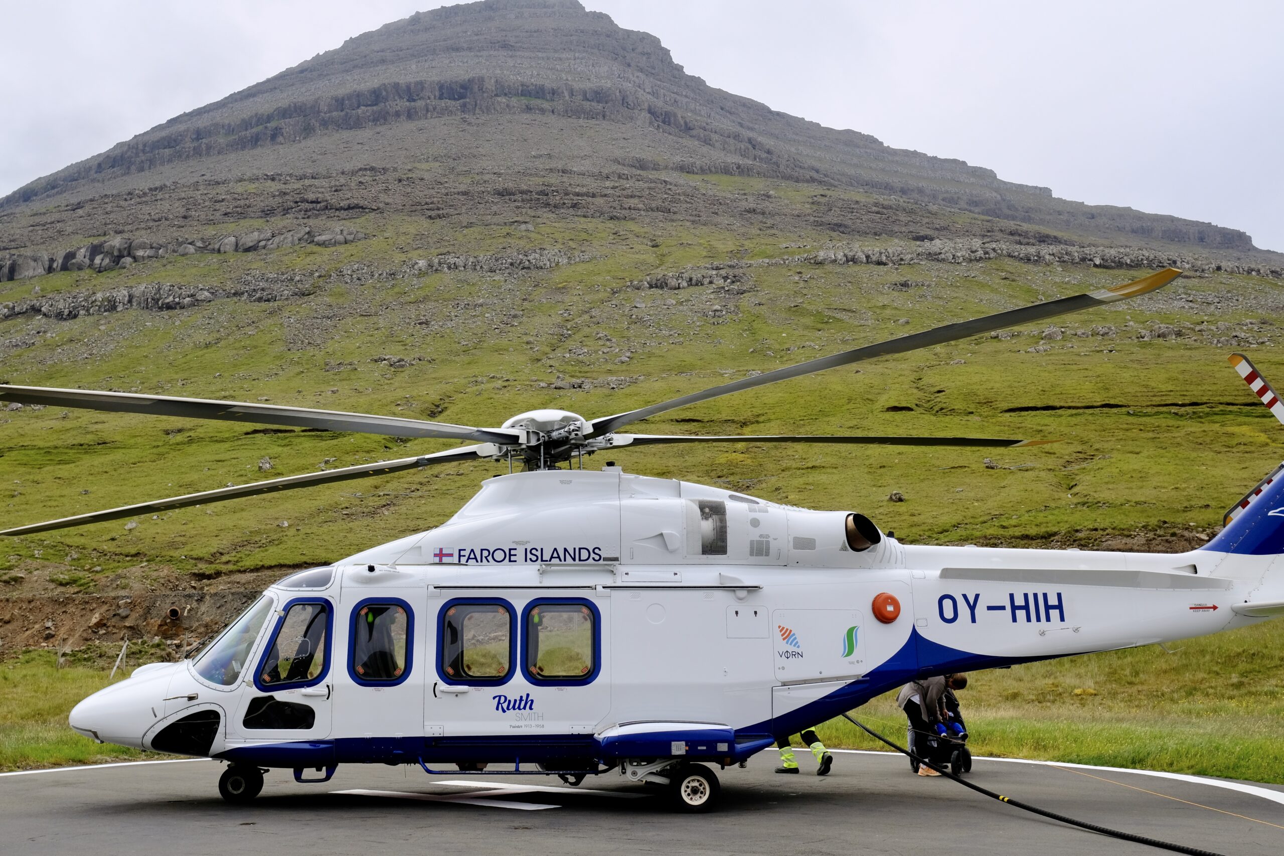
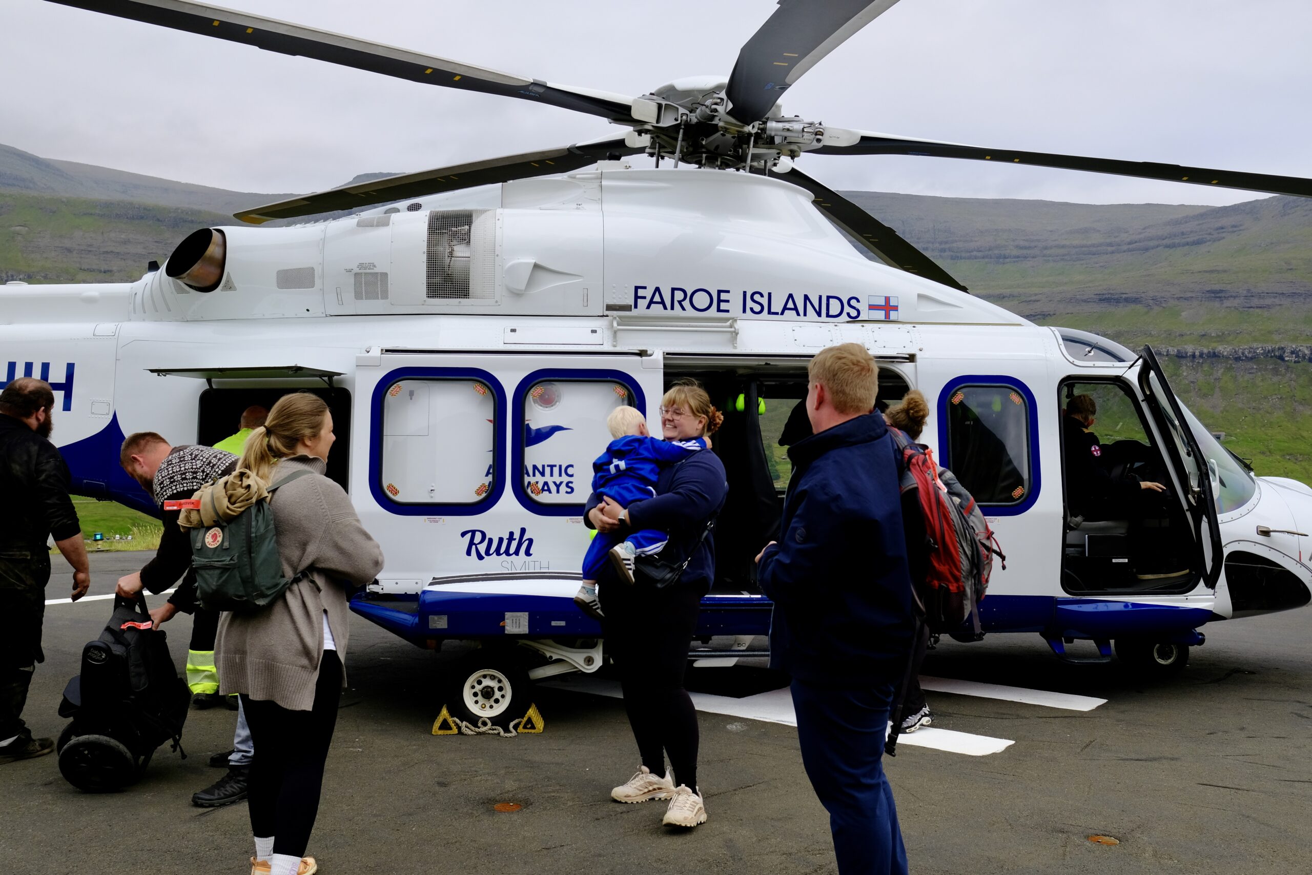
Helicopter during refueling in Klaksvík
All the Atlantic Airways planes and helicopters are named after artists. This helicopter is named Ruth Smith after the painter.

My love for the Faroe Islands is fully reaffirmed after this trip. Studying it the way I have over the last eight years has made me appreciate it even more on this second trip, and I’m certain there will be additional visits at some point. There are 18 islands in the archipelago, one of which is uninhabited. I have now been to 14 of them, including six new islands on this trip: Stóra Dímun, Nólsoy, Sandoy, Skúvoy, Kalsoy, and Fugloy. It seems reasonable to think I could make it to the remaining four someday.

There will be more for me to unpack, from both the explorations on the islands and the time spent working at Williamshús. But it was an excellent trip, with some moments of both luck and inspiration, that feels like it was the right way to wrap up my year in the North Atlantic.

Iceland: Weeks 42 + 43

For most of the last two weeks my parents have been in Iceland. After a couple of days in Reykjavík, we traveled around the country together, driving 1500 miles counter-clockwise on the Ring Road with excursions into Vestmannaeyjar, the Eastfjords, and around various peninsulas. They were on a tour of Iceland in 2021, so there was a little bit of overlap with that, but we did the kind of exploring that a tour would never support: driving down gravel roads deep into mountain passes, roaming the back streets of harbors in tiny fishing villages, tracking down sculptures in the mountains. A couple of years ago there would have been no way they’d be up for some of the hikes we did — up a volcano, on a glacier — but knee replacements do wonders and they have three new knees between them.

There were far too many great sites and moments to chronicle in one post, but I’ll touch on some of the highlights and things that were new to me. I have lots of photosets on Instagram if you want to see more.

On top of the Eldfell volcano in Vestmannaeyjar (Westman Islands).
Map of my road trip around Iceland with my parents in May 2026.

Our first stop was Vestmannaeyjar, which was the trickiest to plan around because the ferry is operating on a single engine and can’t make it across the strait in bad weather. Luckily the weather was good enough to sail there on schedule, but on advice from an agent at the ferry terminal I swapped our return trip the next day to be the first ferry out at 7am, in order to guarantee that we wouldn’t be trapped.

I love those islands, and was happy for another chance to hike up the Eldfell volcano to get a view of the whole archipelago. It was a lot greener when I was there last August, but this trip offered the chance to see a new site-specific artwork by Ólafur Elíasson that was installed earlier this month. It’s called “The Wanderer’s Perspective” and consists of two parts: a viewing sphere that frames the volcano, and a new walking path up to its summit (still in development). The walking path will follow the route of a giant piece of lava from the 1973 eruption that was nicknamed Flakkarinn (The Wanderer) because of how far it traversed across the landscape.

The viewing sphere is easily accessible, and frames the volcano in a way that the sun aligns with the volcano’s peak at 1:30pm on January 23, the exact date and time of the eruption. Circular holes in the roof trace the sun’s trajectory on July 3, the day the eruption was declared over.

“The Wanderer’s Perspective” by Ólafur Elíasson

Leaving the Westman Islands we visited lots of spots along the south coast, and it turned out that the earlier ferry was a great idea because there’s so much to see along this stretch. We stopped by the Seljalandsfoss and Skógafoss waterfalls of course, but also the Sólheimajökull glacier, Reynisdrangar beach, and Hjörleifshöfði cave. The next day we hiked the Fjaðrárgljúfur canyon and walked on the Svínafellsjökull glacier before it started raining heavily. That may have contributed to lack of ice on Diamond Beach, but it was still fun to check out the massive icebergs in Jökulsárlón glacial lagoon.

My parents at Fjaðrárgljúfur canyon.
Svínafellsjökull glacier tongue
Jökulsárlón glacial lagoon

After staying in the night in Höfn, we drove into the Eastfjords the next day, venturing further east than I’d been in Iceland before. It immediately felt different for me, taking in new sites versus driving through ones I’d seen two to four times before. More firsts came fast, as this region is where the wild reindeer live and we added them to our animal sightings along with the pervasive sheep and horses. It was earlier enough in the year that their antlers were still velvety and we even spotted a couple of calves.

Reindeer in the Eastfjords
Two reindeer in the Eastfjords
A female reindeer and her calf, in the Eastfjords.

Also in the Eastfjords was Petra’s Stone Collection, an absolutely amazing place showcasing a single woman’s collection of rocks and minerals found all around Iceland over her lifetime. It is impossible to convey the size and scope of her collection but it’s like nothing I have ever seen. See my Instagram photoset for more.

Petra’s Stone Collection
I can’t believe how many colors and textures were in this one rock.

We stayed in Seyðisfjörður, which is reached by driving over a mountain pass that was still covered in deep snow. The town is where the Smyril Line ship arrives in Iceland after sailing from Denmark via the Faroe Islands. It’s also one of the two locations that were used in the Icelandic TV series Trapped, the other being Siglufjörður where we also stayed a few days later. I’m looking forward to rewatching the show now that I’ve spent time in both places.

Sheep with her lamb in Seyðisfjörður.

While there, we also hiked up the mountain to see Tvísöngur, a sound sculpture by the German artist Lukas Kühne that consists of a series of interconnected concrete domes. The plaque notes that it can be viewed as a visualization of the Icelandic five-tone harmony tradition, and dubs it “singing concrete.” The experience is that if you stand directly underneath each dome your voice resonates strongly back to you, in an effect that feels as if you have headphones on, piping your amplified words back into your ears. It’s a strikingly simple design but a really fun and powerful effect.

Tvísöngur sound sculpture

Nearby was another sculpture, squarely aligned with my interest in subsea cables, called “Hvernig gengur?” — How is it going? — and was commissioned by Iceland Telecom to commemorate the 100th anniversary of the first telegraph cable laid between Scotland and Iceland in 1906, which came ashore in Seyðisfjörður.

Hvernig gengur? sculpture.

Our next stop in the Eastfjords was Borgarfjörður Eystri, the puffin capital of Iceland, where an islet named Hafnarhólmi is home to thousands of burrows. Stairs and platforms allow visitors to walk around part of the islet, providing an extremely close up view of the puffins from every possible angle. When we arrived, this closeness already made it the best puffin site I’d been to, even surpassing Mykines on the Faroe Islands. But soon after 8pm a majority of the birds that had been out to sea returned, in a seemingly coordinated ritual. At that point the hills were absolutely swarmed, with puffins taking off and landing, going in and out of their burrows, billing their mate, and strutting around.

The crowd gathered to view them all seemed to understand what a special moment this was, adopting library-hushed speaking levels and careful footsteps; it was a quiet and reverent place. These funny little birds have the ability to make everyone smile as they awkwardly fly and waddle around on their bright orange feet.

Puffin at Borgarfjörður Eystri.
Puffin at Borgarfjörður Eystri about to take flight.
Puffin at Borgarfjörður Eystri with its mouth open.

As we started heading northwest, our first stop was the hike to Stuðlagil canyon. The water at this time of year isn’t the turquoise color you often see in photos, but the basalt columns along the river’s edge are stunning. If you’re thinking of going, I recommend hiking in on the east side of the canyon. The west side has more infrastructure, and you can drive up to the lookout spot, but there are still hundreds of steps down to the river and you can’t walk down into the canyon. You’ll see some of it, but most of the views will be just out of sight. The eastern side has a new parking lot further along the canyon, so it’s now only a ~3 miles hike instead of what used to be ~6 miles.

Stuðlagil canyon from the eastern bank
Stuðlagil canyon

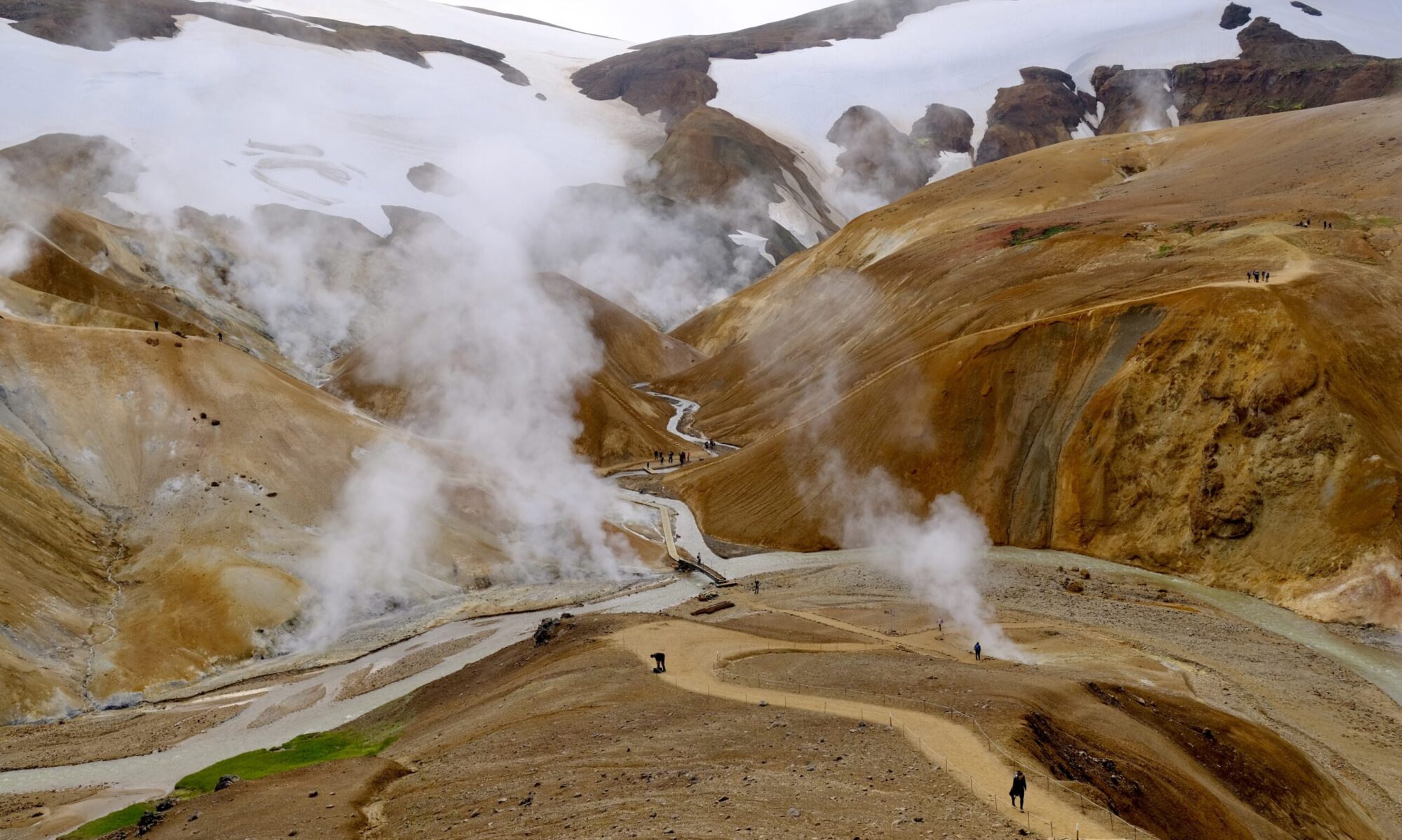
As we headed west we started to get back into areas of North Iceland I’d visited in early April. We went to the Hverir geothermal area, visited the cows at Vogafjós Farm Resort, stayed on a farm near Lake Mývatn, and visited Goðafoss. There was a massive cruise ship docked in Akureyri, deploying 20+ full-size buses to the sites in the area. I’m not a fan of that kind of travel, or being around those kinds of crowds, so it was nice to head up the peninsula to Siglufjörður where we spent the last two nights of the trip.

It was rainy, and even snowed, the final two days — but that was okay. We stayed at the excellent Sigló hotel, which has a geothermal hot tub overlooking the harbor and mountains that is great in any weather. We also visited The Herring Era Museum, which has excellent artifacts from the town’s history when it was Iceland’s fish export epicenter.

Hot tub at the Sigló hotel in Siglufjörður.
Rainbow over Eyjafjörður.
Sauðanesviti lighthouse

As we headed back to Reykjavík we detoured to see the sea stack Hvitserkur. We also passed by one of the most interesting sheep roundup pens I’ve seen in Iceland, situated unusually right by the beach.

Hvitserkur sea stack
Sheep roundup pen by the ocean, just north of Hvammstangi on route 711.

The final trip was to the Reykjanes Peninsula, to drop my parents off at the airport but also to explore the area around Grindavík. We saw the fresh lava flows that covered the old road, as well as the magma barrier walls that surround the power plant and town.


Overall, it was a great trip around the country and I’m happy that I was able to do it with my parents. One of the interesting things about traveling with other people is that they notice different things than you do. When my brother visited Iceland he pointed out many aspects of the architecture that I hadn’t seen. My Mom notices artifacts, furniture, and how people construct their homes in ways that I might overlook. She also has an incredible eye for interesting rocks and was always finding good ones as we hiked. My Dad, not surprisingly, sees the farming activity in rural Iceland with a level of depth that most of us would overlook. I see the tractors, sheep, and hay bales but he’s looking at soil type, fertilizer composition, and water management practices. We all have our travel eccentricities — I did track down a monument to a telegraph cable after all — but it was interesting to see Iceland through their eyes.