Iceland: Week 4

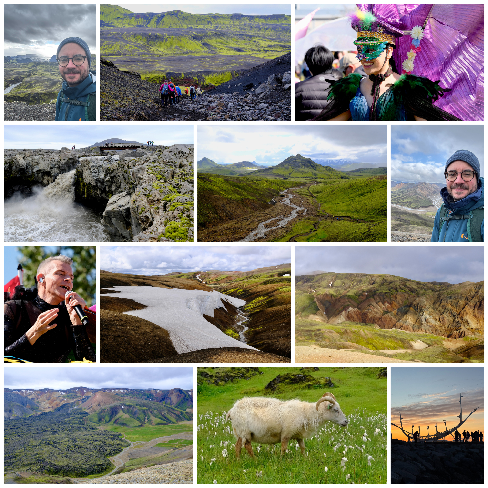
More than half of last week was spent outside, hiking in the Highlands between Landmannalaugar and Thórsmörk on the Laugavegur trail. I’ve had my eye on this trek for a long time, and it lived up to all my expectations. I went with a guided group, 16 of us in total, and hiked 40 miles over 4 days, traversing 6,000 feet of elevation gain across wildly different landscapes. It was often cold, windy, and rainy, but with fabulous views, otherworldly scenes, and a chance to have my morning coffee at the foot of a glacier — an excellent mix of Type 1 and Type 2 fun.

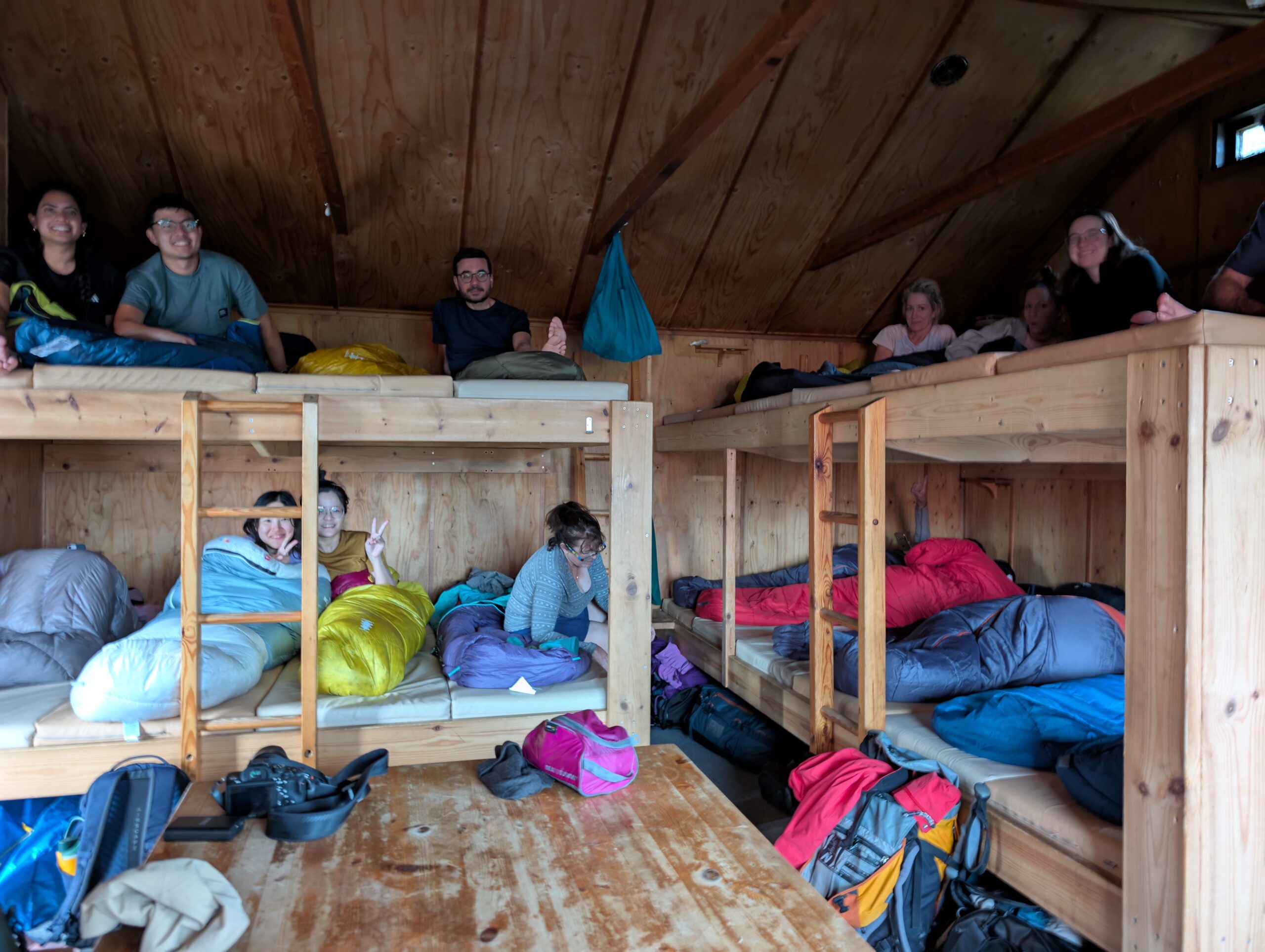
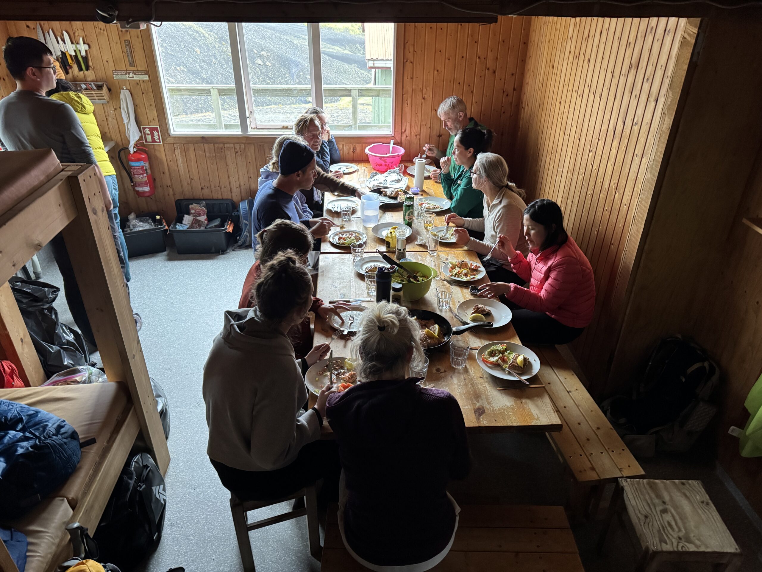
Going with a group has distinct benefits, particularly as a solo traveler. For one, I had someone to talk to, and our guide turned out to be wonderfully low-key and happy to answer all my questions. It also meant that I only had to carry a daypack, as the company transported our other bags as well as food. We stayed in mountain huts, originally constructed in the 1970s by a hiking club, which are simple structures filled to the brim with sleeping mats and a kitchen. Lots of people stay in tents as well, and there are shared bathroom facilities for everyone. For 1,000 ISK you can buy 5 minutes of hot shower time. Overall, accommodations are basic, but having tubs of food for our group transported by vehicle meant meals could be a couple notches above backpacker food.

I have photosets on Instagram for each day (Day 1, Day 2, Day 3, Day 4), so I won’t overdo it on the photos here, but below is a brief daily overview.

Day One: Landmannalaugar

Landscapes at Landmannalaugar
Leaving the lava field at Landmannalaugar, approaching the hut and campground

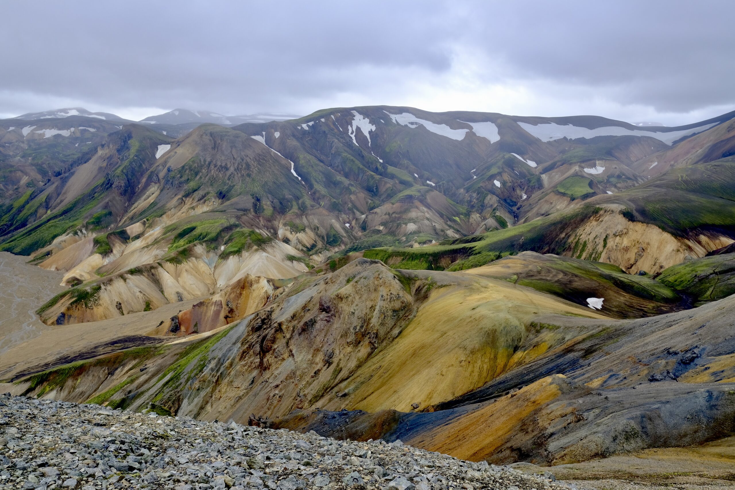
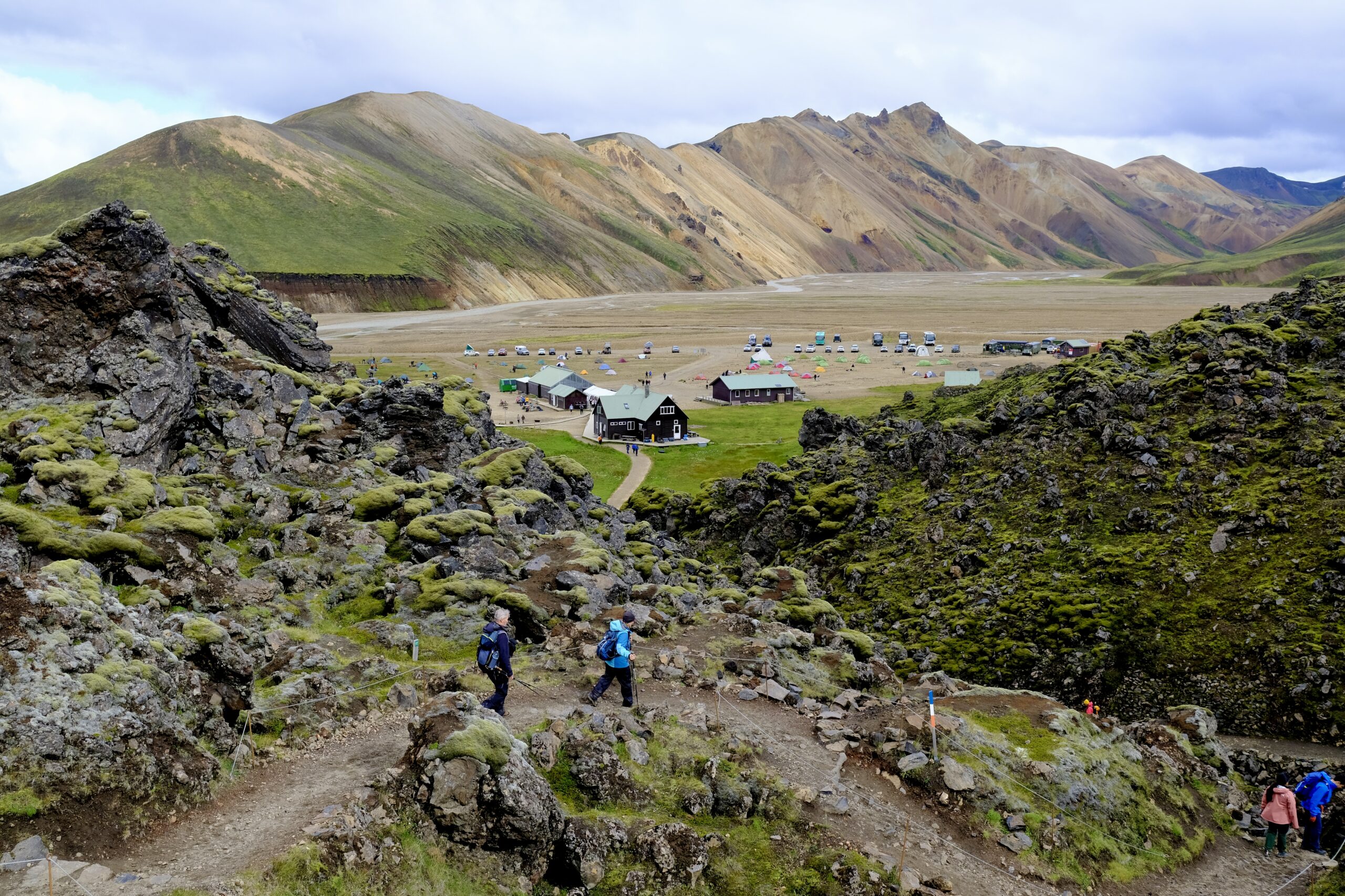
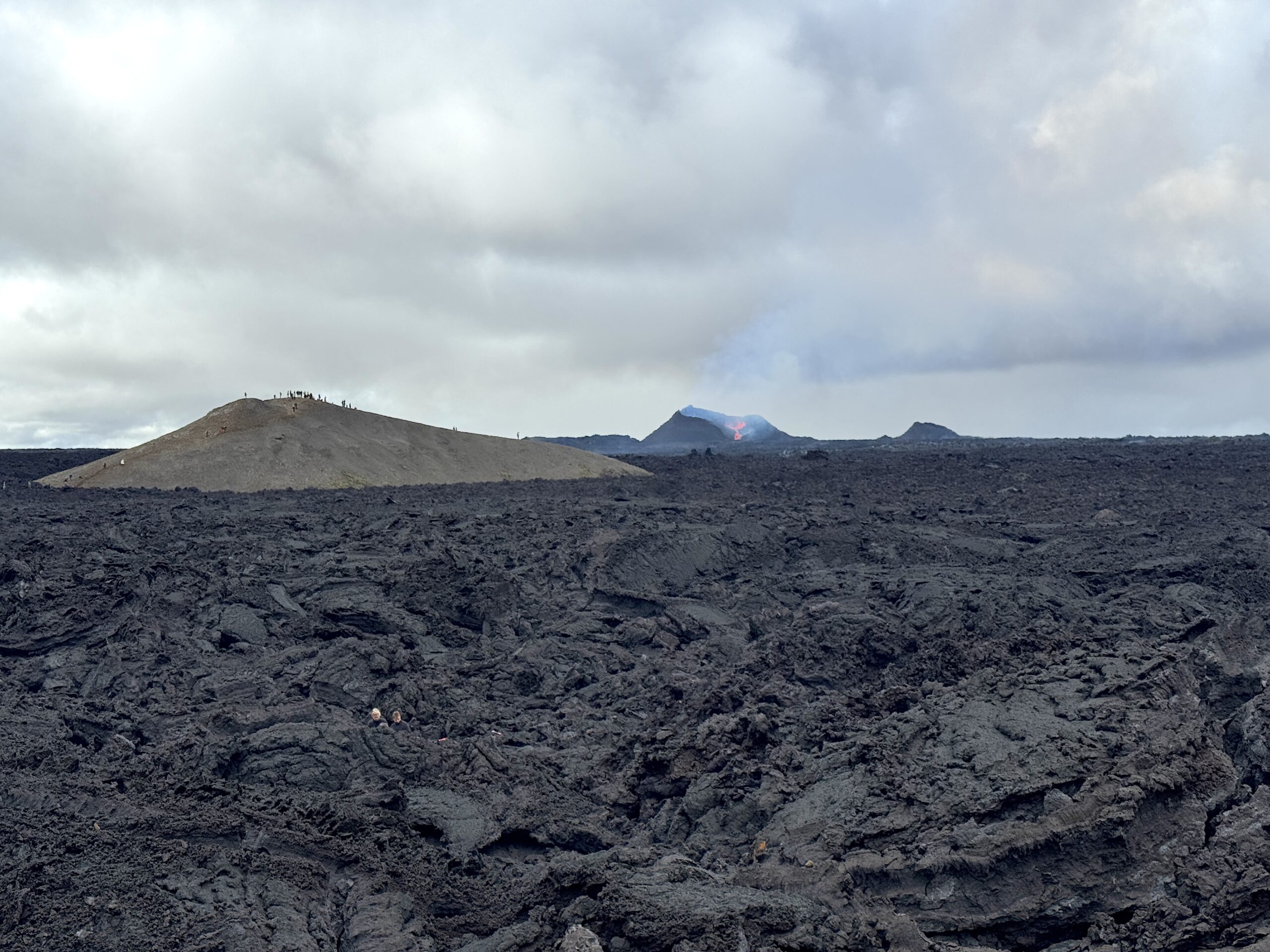
The trip to Landmannalaugar from Reykjavík took about 3.5 hours, which would make it possible to do as a very long day-trip. We didn’t actually start on the Laugavegur Trail this first day, but did a four-hour hike through the colorful landscapes and lava fields of the area. It was the windiest of all the days, and threatened to downpour as it had the the day before. But the rain remained scattered, with patches of blue sky, and it was a great introduction to the trip.

We stayed in the hut in the center of the above photo, the only one on the trip with hot water on tap since this was a geothermal area. A hot spring runs in front of the hut, feeding a pool a short distance away, which felt amazing to soak in after the hike. It was my first natural hot spring in Iceland and it was fun to see how you could moderate the temperature by positioning yourself within the pool. As you moved closer to the river it got uncomfortably hot, but you could also get extra heat by digging your feet or hands into the pebble-covered ground.

A very Icelandic scene: sheep grazing with people bathing in a hot spring in the distance.

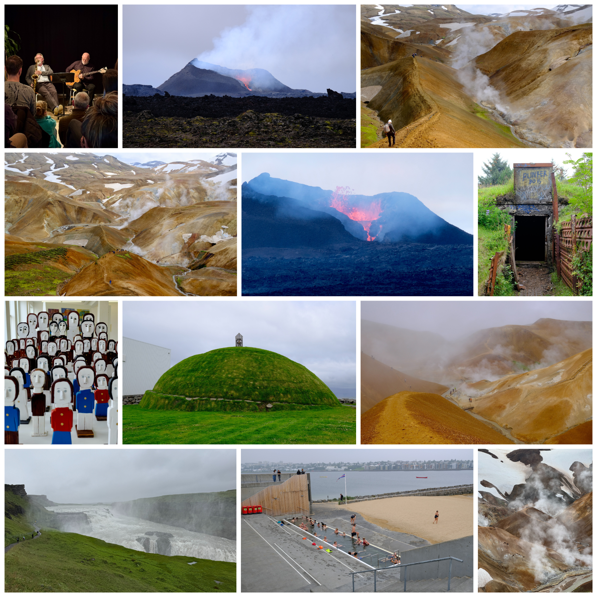
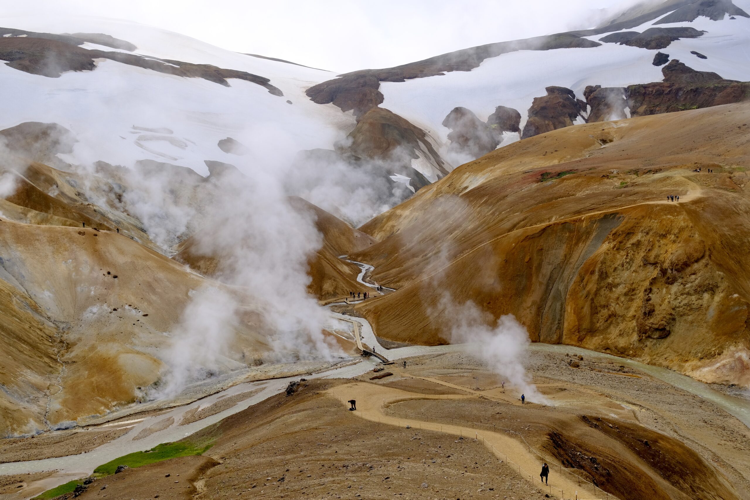
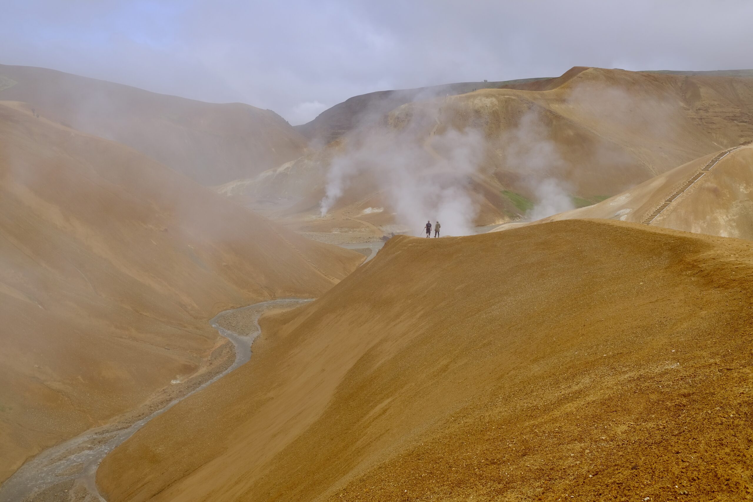
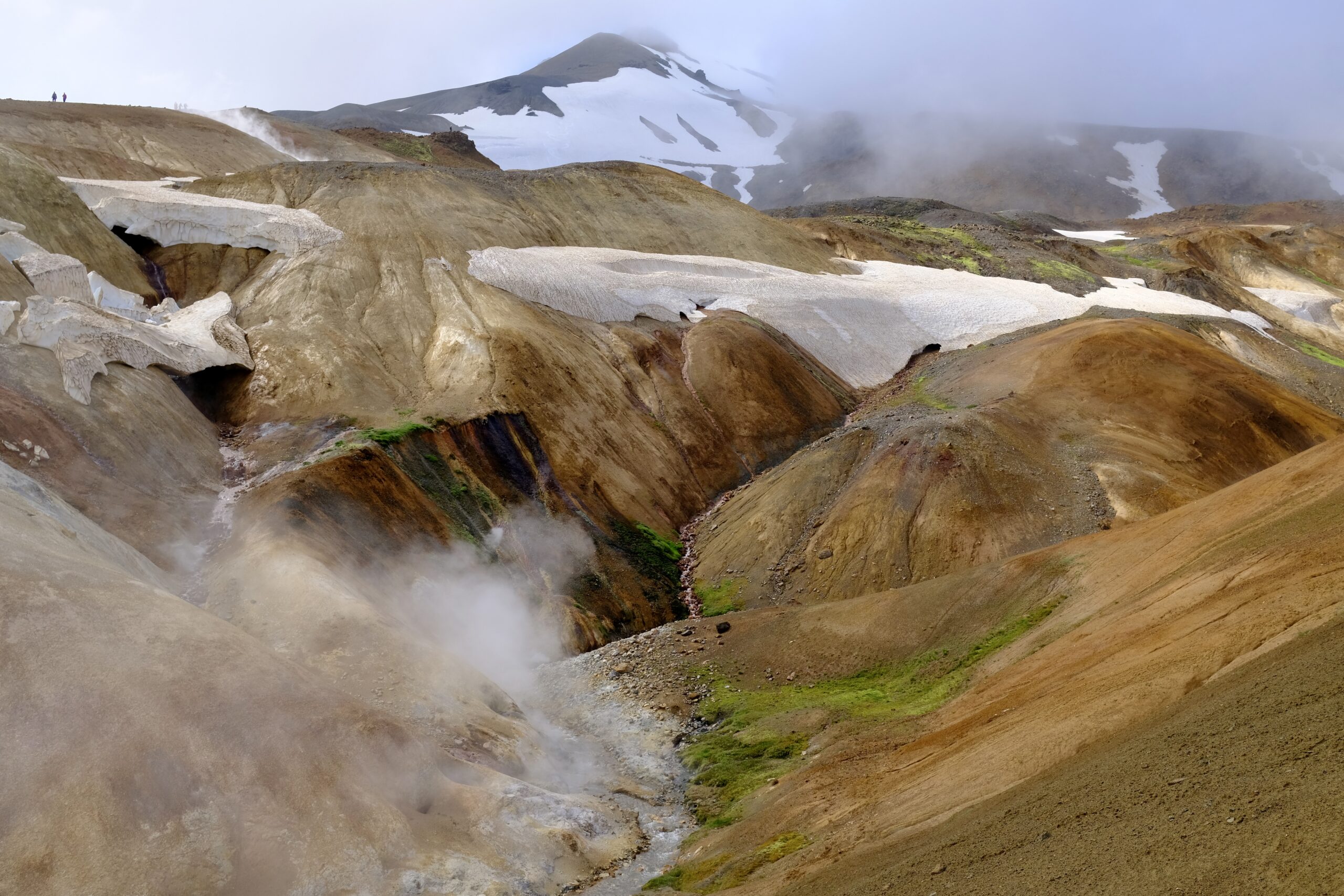
Day Two: Landmannalaugar to Álftavatn

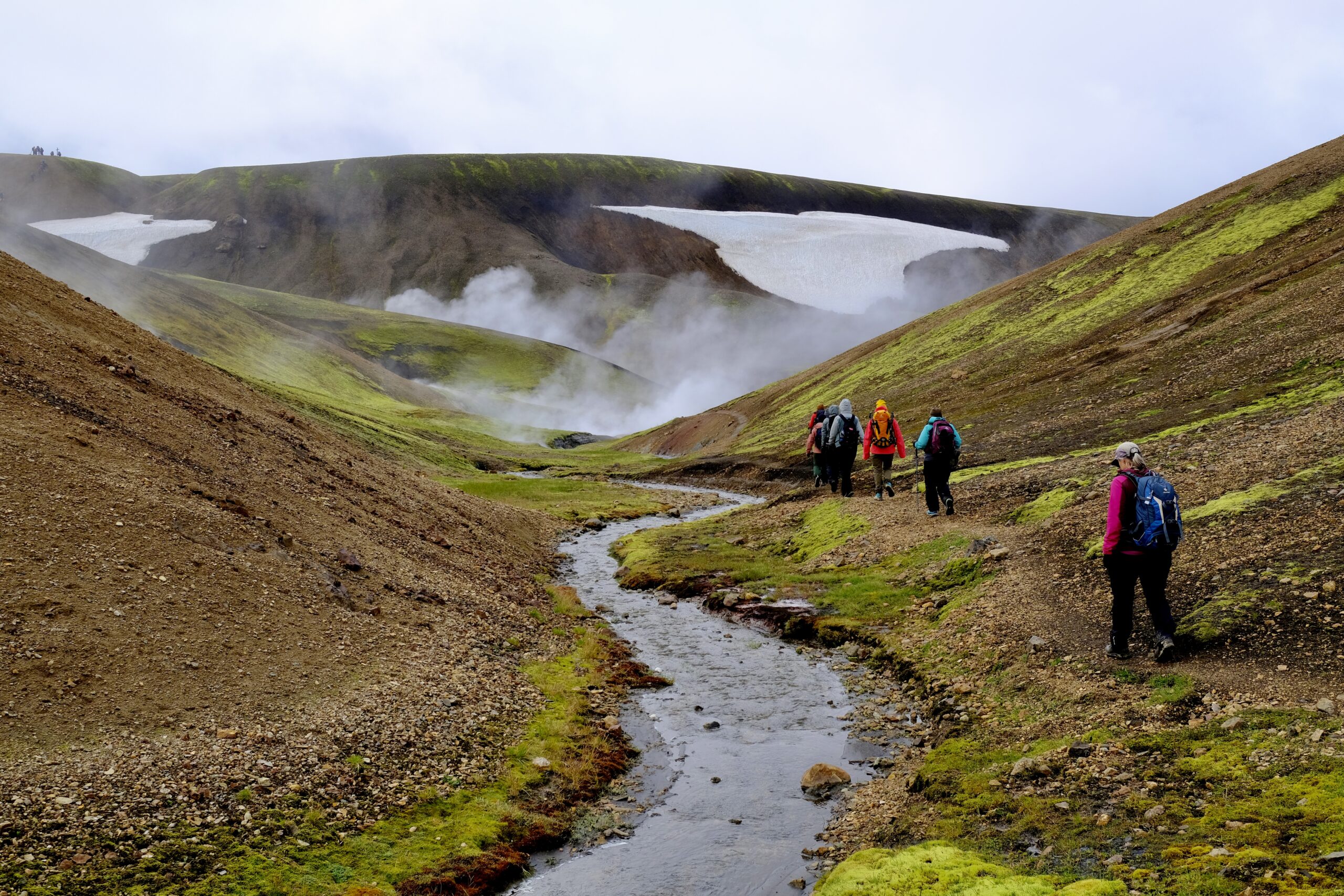
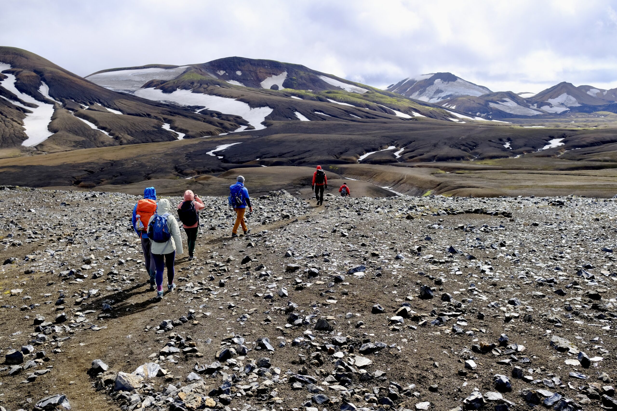
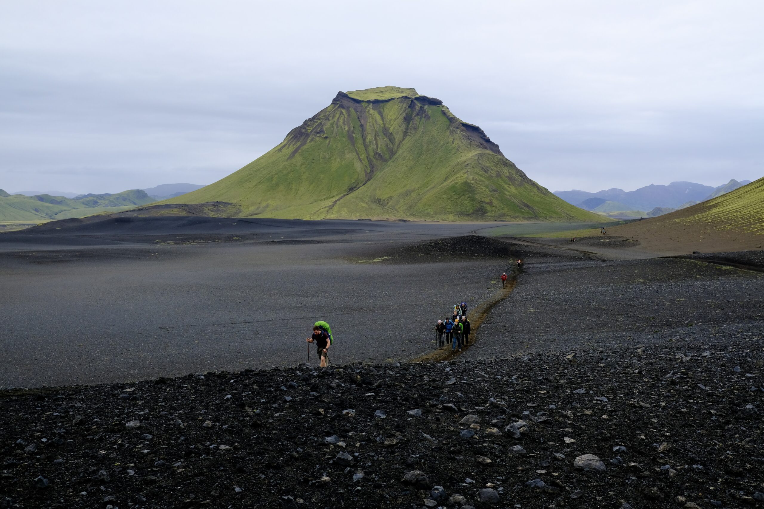
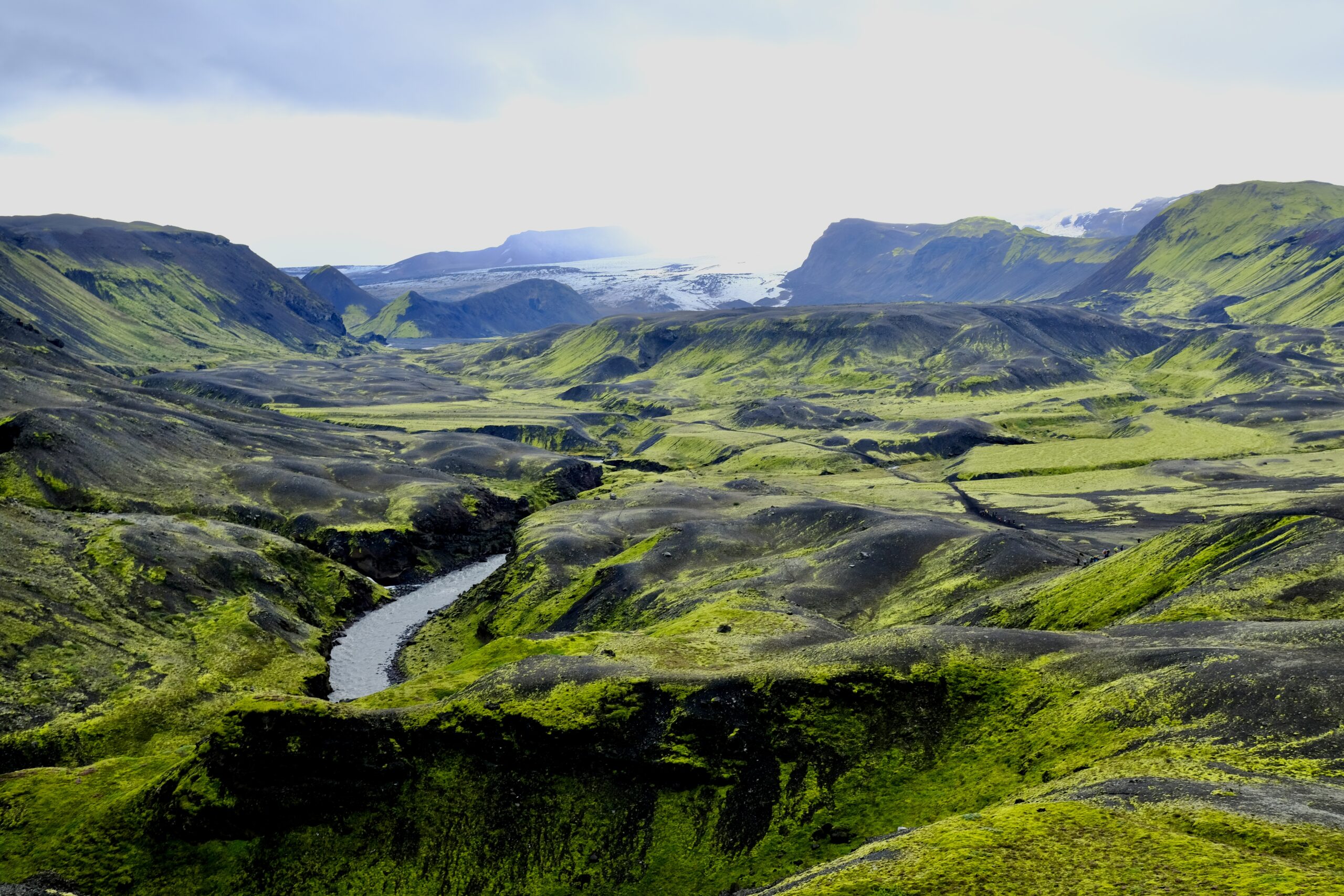
The second day was the longest, at 15 miles, and was technically two segments of the trail as we passed by the Hrafntinnusker hut halfway through. It also had the most elevation. The day started with steamy geothermal landscapes, including steam vents and mud pots, giving way to rockier and snow-covered terrain as we passed over a mountain pass. The trail only opens in mid-June, because the snow pack is too deep before then. We were continuously going up and down, as the trail runs through numerous valleys, although some were still filled with snow that bridged across them. You have to be careful as you cross those because the snow melts from both the top (sun) and bottom (hot springs), potentially obscuring the true depth of the snow you’re walking across.

Steamy hot springs provided an otherworldly feel throughout the day.
The landscape became rockier and snowier mid-day.

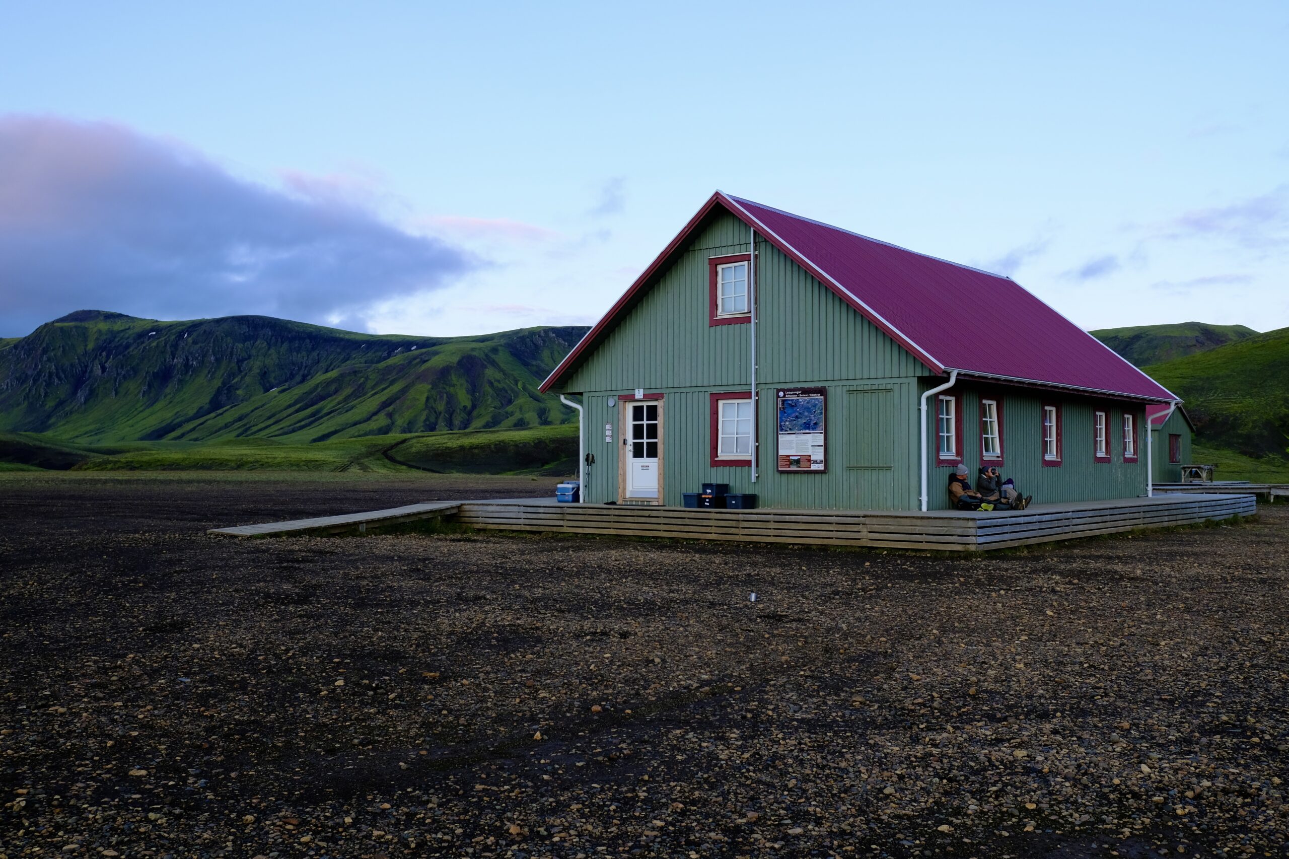
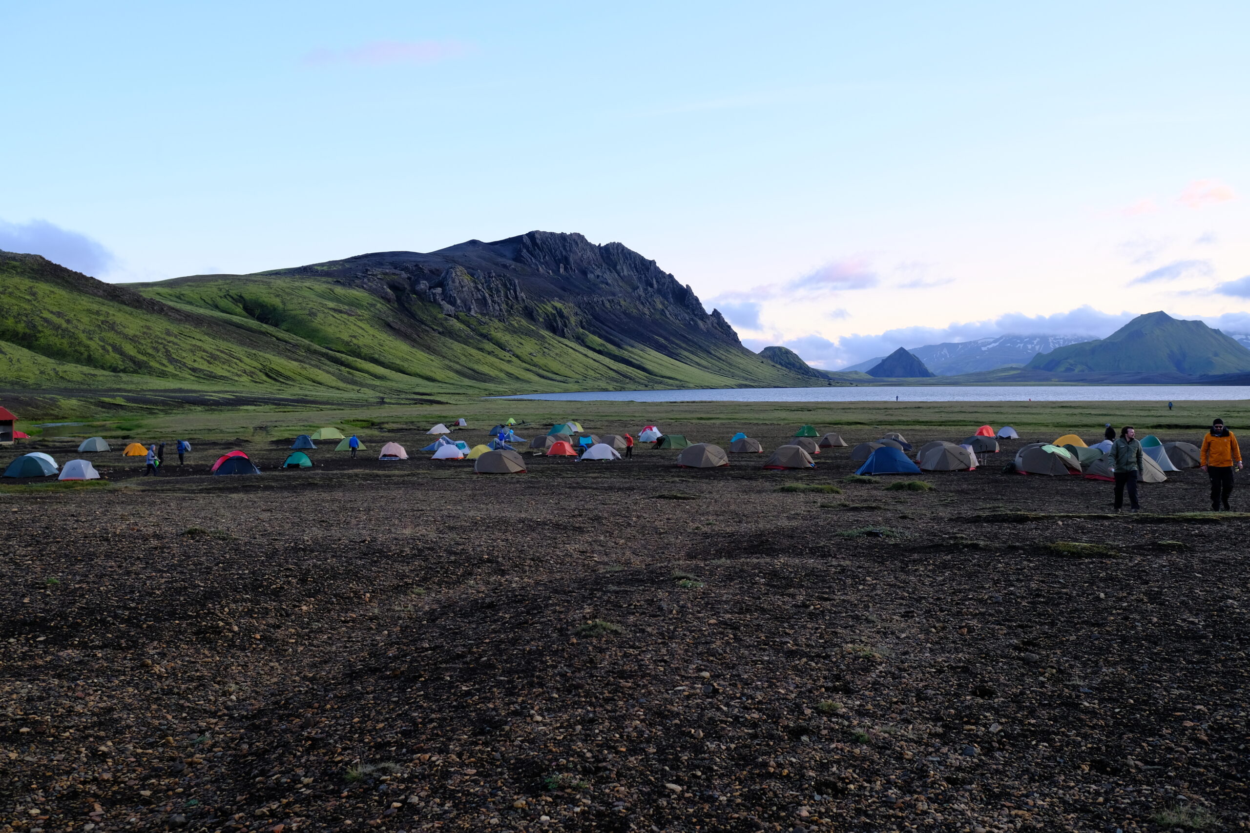
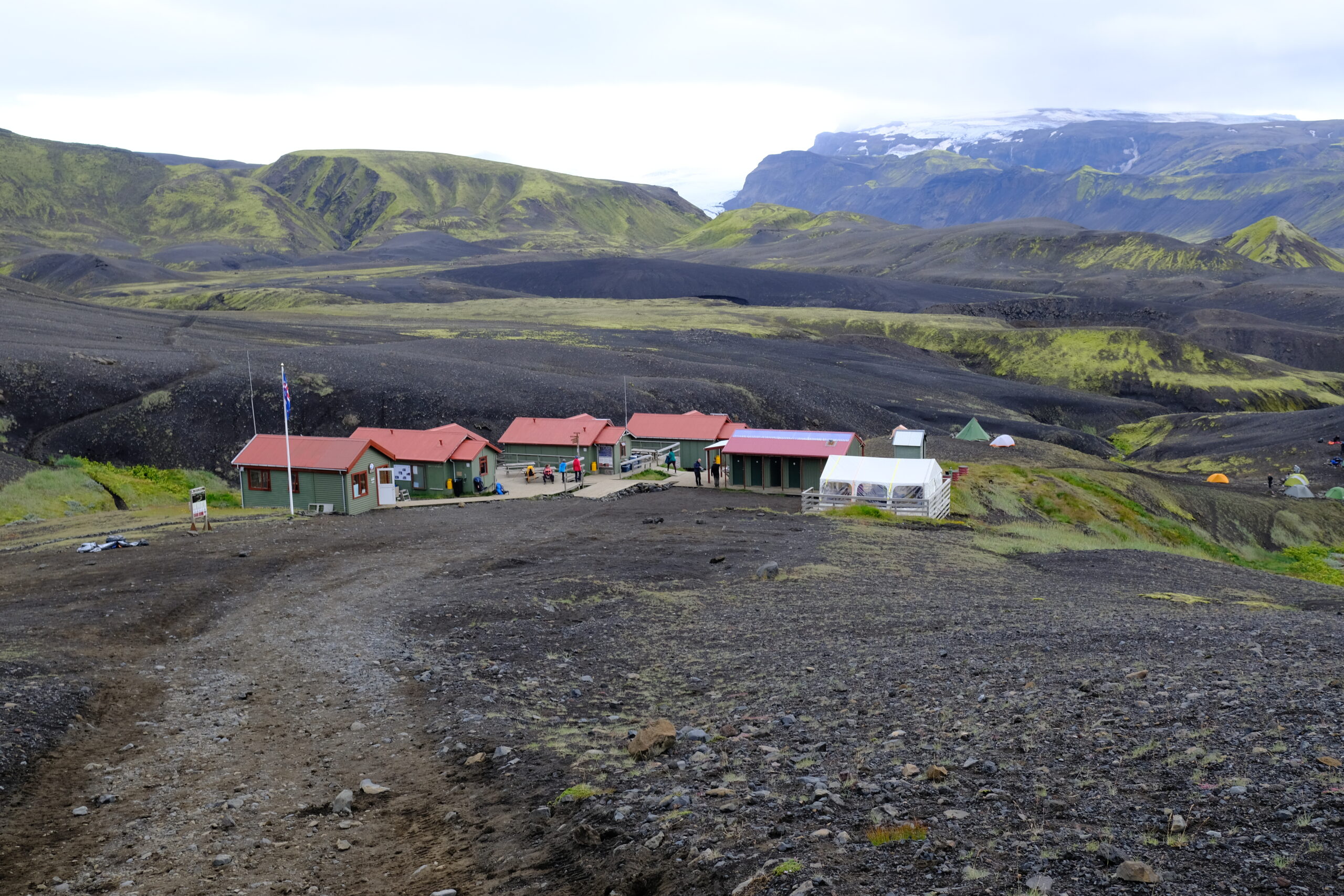
The hut at Álftavatn was the best of the trip with more spacious quarters and a generously sized kitchen, beautifully situated on the edge of a lake. The multi-hour steep downhill trek to the campground wrecked havoc on our feet, but just before arrival we had our first river crossing and the freezing cold water helped to sooth the swelling. There were four river crossings in total on this hike, and I carried an extra pair of water shoes for them. They were bone chillingly cold, but a fun part of the experience as I’d never done it before.

The hut at Álftavatn.
Camping area at Álftavatn, next to the lake.

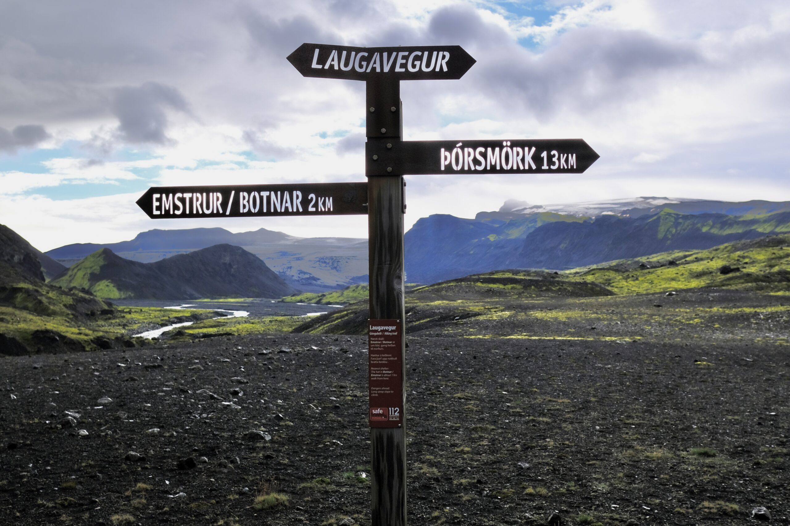
Day Three: Álftavatn to Emstrur (Botnar)

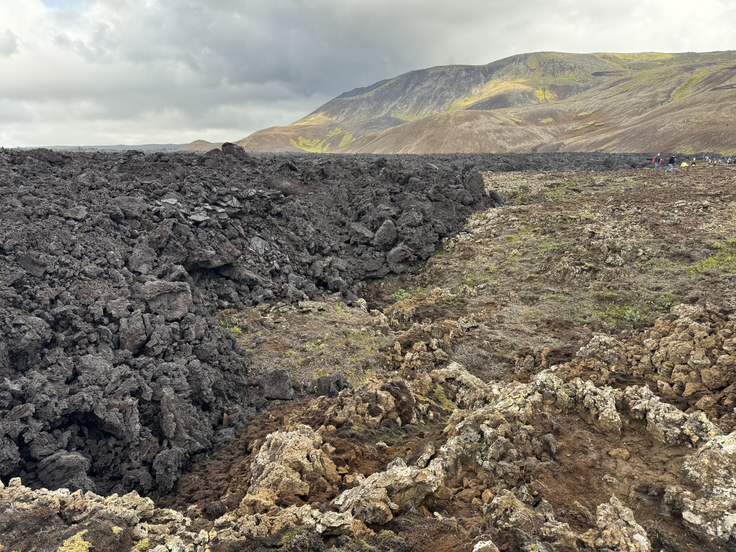
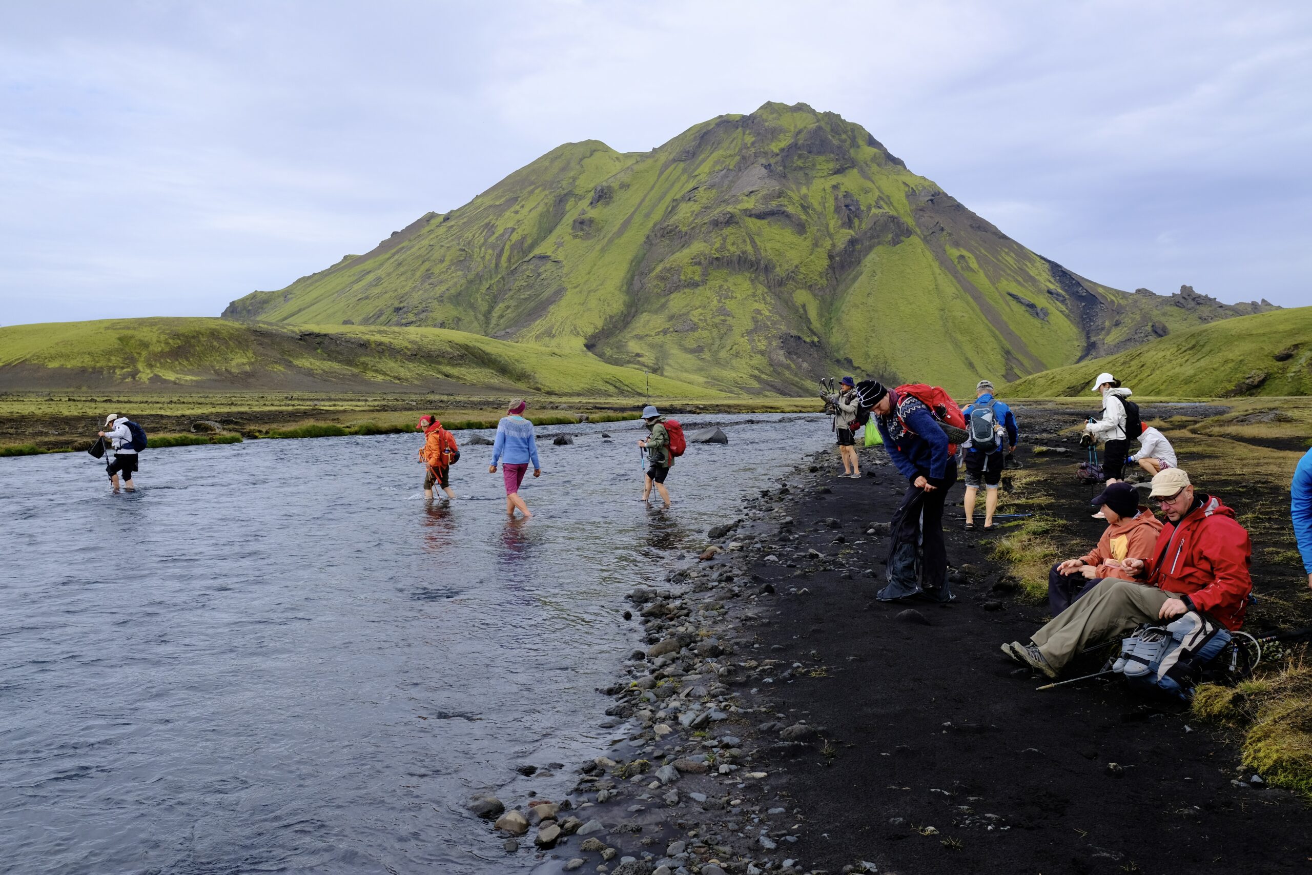
The third day saw a dramatic shift in scenery, away from the colorful geothermal hills to a stark black and green landscape. It was rockier, and much flatter than previous days. There was another river crossing less than an hour into the hike, and I think there is where I made the mistake of not fully cleaning all the tiny rocks out from between my toes after the crossing. By the end of the day I’d discovered that the smallest toe on my right foot was lacerated where it joined my foot; I think a small stone had abraded it all day as a walked. It wasn’t terrible, and better than getting a blister, but made the final day of hiking a bit uncomfortable.

River crossing
Much of the day was starkly black and green. There’s no life up there, no birds or sheep.

The siting of our final huts at Emstrur/Botnar was beautiful, situated in a valley next to a glacier, but they were also the most cramped. It was raining steadily when we arrived, which means the 21 people staying in tiny hut #2 were all huddled inside trying to dry off.

The Emstrur/Botnar huts.
Glacial view from the hut.
Packed sleeping quarters.
We had to eat in shifts in this tiny hut because there wasn’t quite enough room around the tables.

Day Four: Emstrur (Botnar) to Þórsmörk

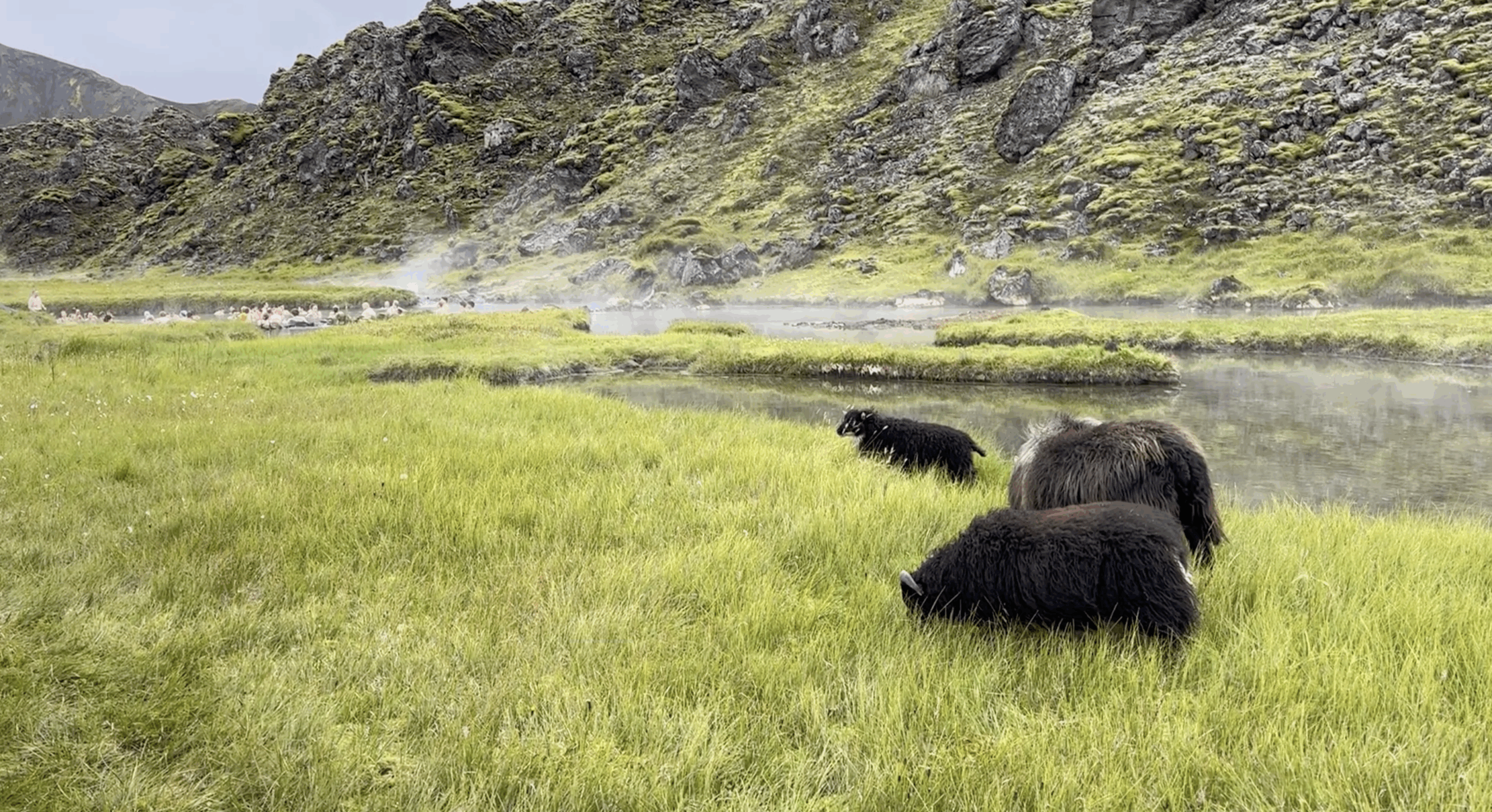
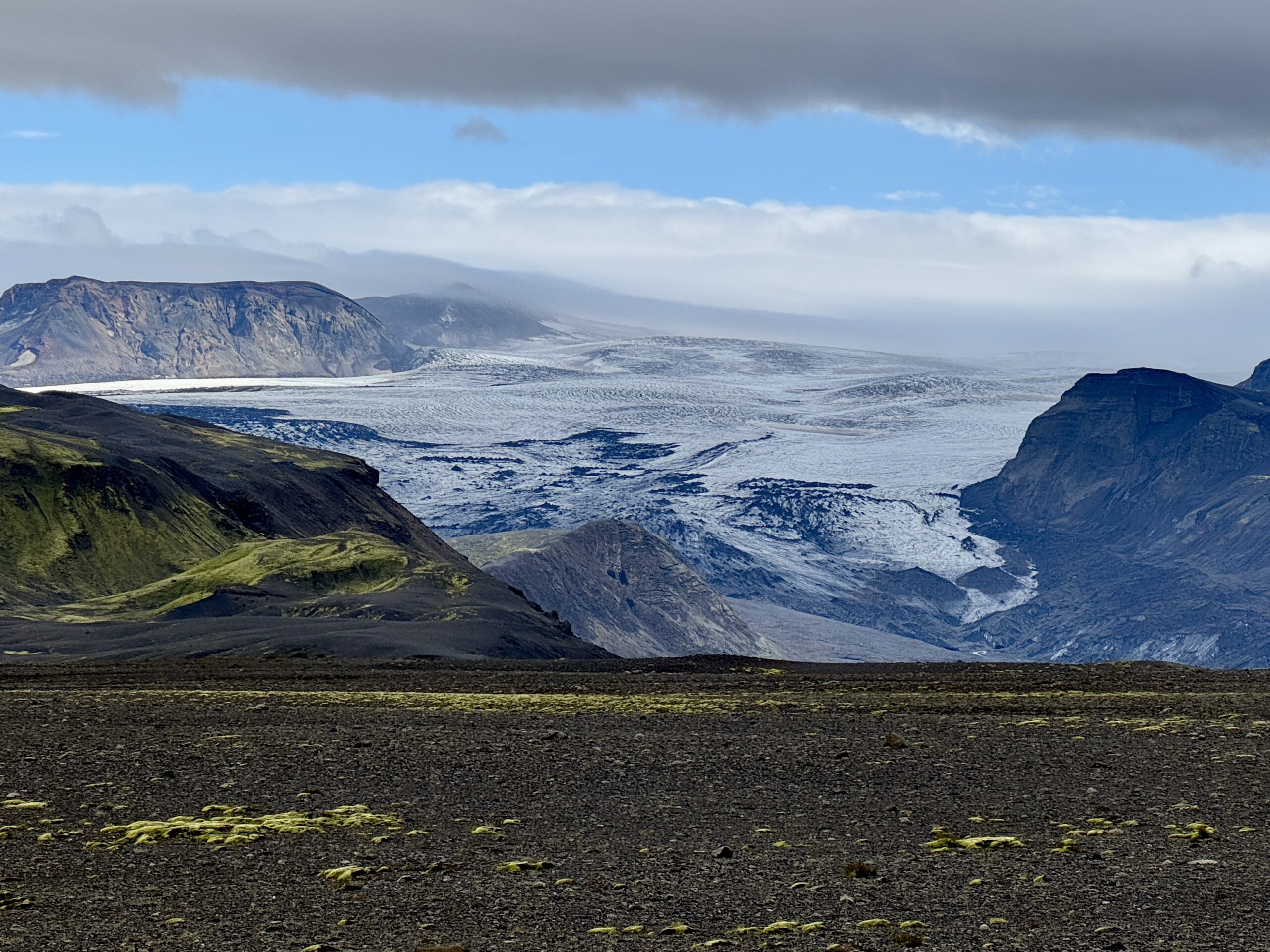
On the final day, the trail ended at Thórsmörk, one of the only native forests in Iceland. You could observe life returning as the day progressed, with a few birds flying over canyons and ewes leading their lambs around the hills. During this segment we travelled between the Mýrdalsjökull and Eyjafjallajökull glaciers, ending in a flood plain with clear views of both. Between the biggest river crossing, feeling a bit weary, and my slightly wounded foot, I ended up relying on my hiking poles more during this segment. I used them periodically throughout the trail when I felt the need for additional stability, like going down a steep and muddy decent, but there was always a tradeoff between holding my poles or my camera.

Valley with Mýrdalsjökull galcier in the background.
These signs were found throughout the trail. Punching the letters out of metal is smart, as I doubt that a painted sign would last very long in this environment.
My group at the end of the Laugavegur trail. We were a mix of people from the USA, Canada, Switzerland, Taiwan, and Norway.

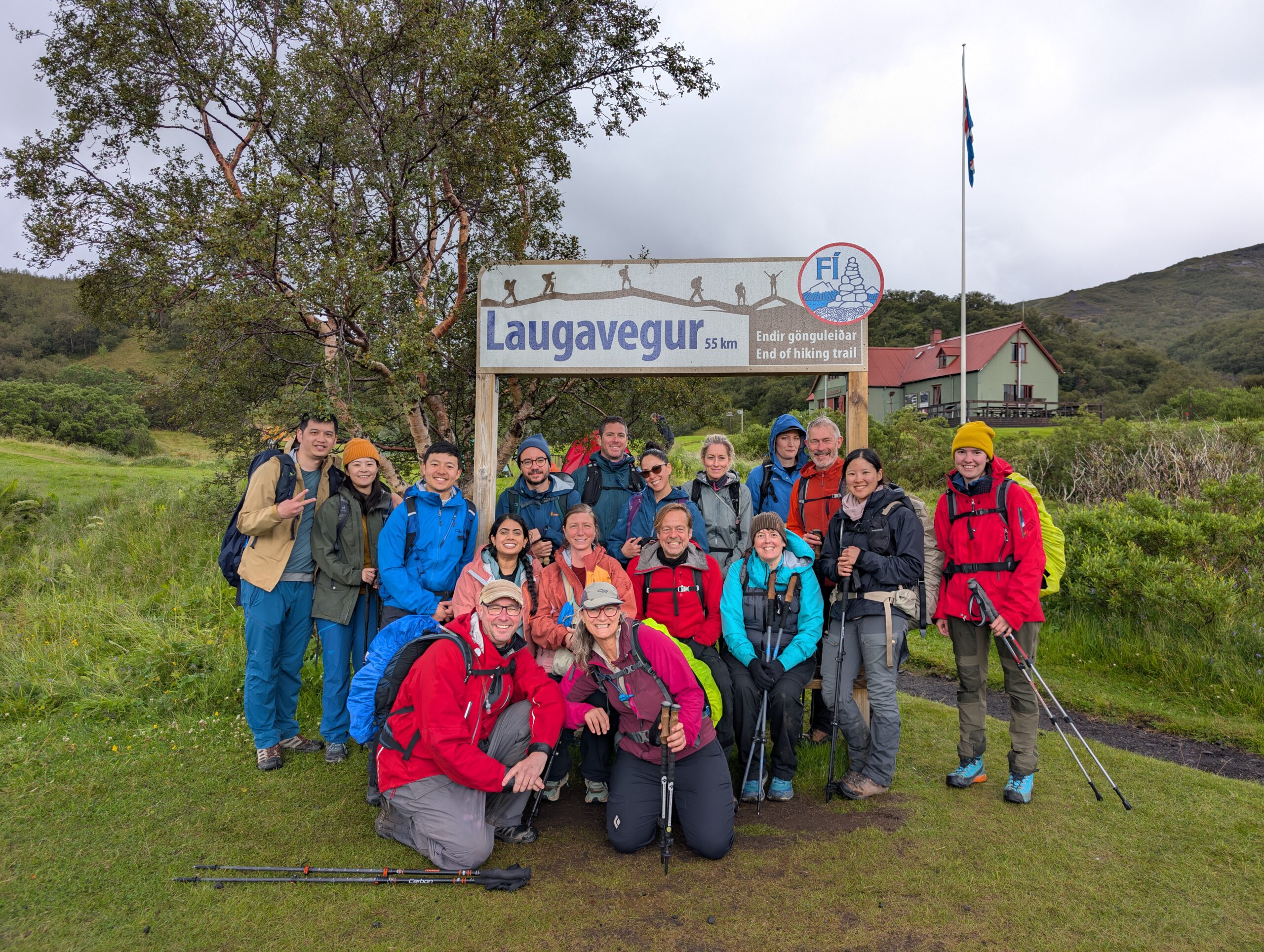
We didn’t stay in the hut at Thórsmörk, although they did let us relax there while waiting for the bus to arrive. There are additional trails in that area that looks great, and three huts in total. Most of the people doing the full hike were foreigners, but I was told that Thórsmörk is a place that native Icelanders regularly come to recreate. I might try to make my way back here, for a day trip or a night in a hut. But the season for the Highlands is very short: basically mid-June to mid-September.


Getting back from the hike I laid low for a couple of days, catching up on sleep, laundry, and email. But I was able to register for my classes, and getting the syllabus’ and schedule provides me with a sense of the structure that I’ll have starting August 18th. I’ll share more as things get going.


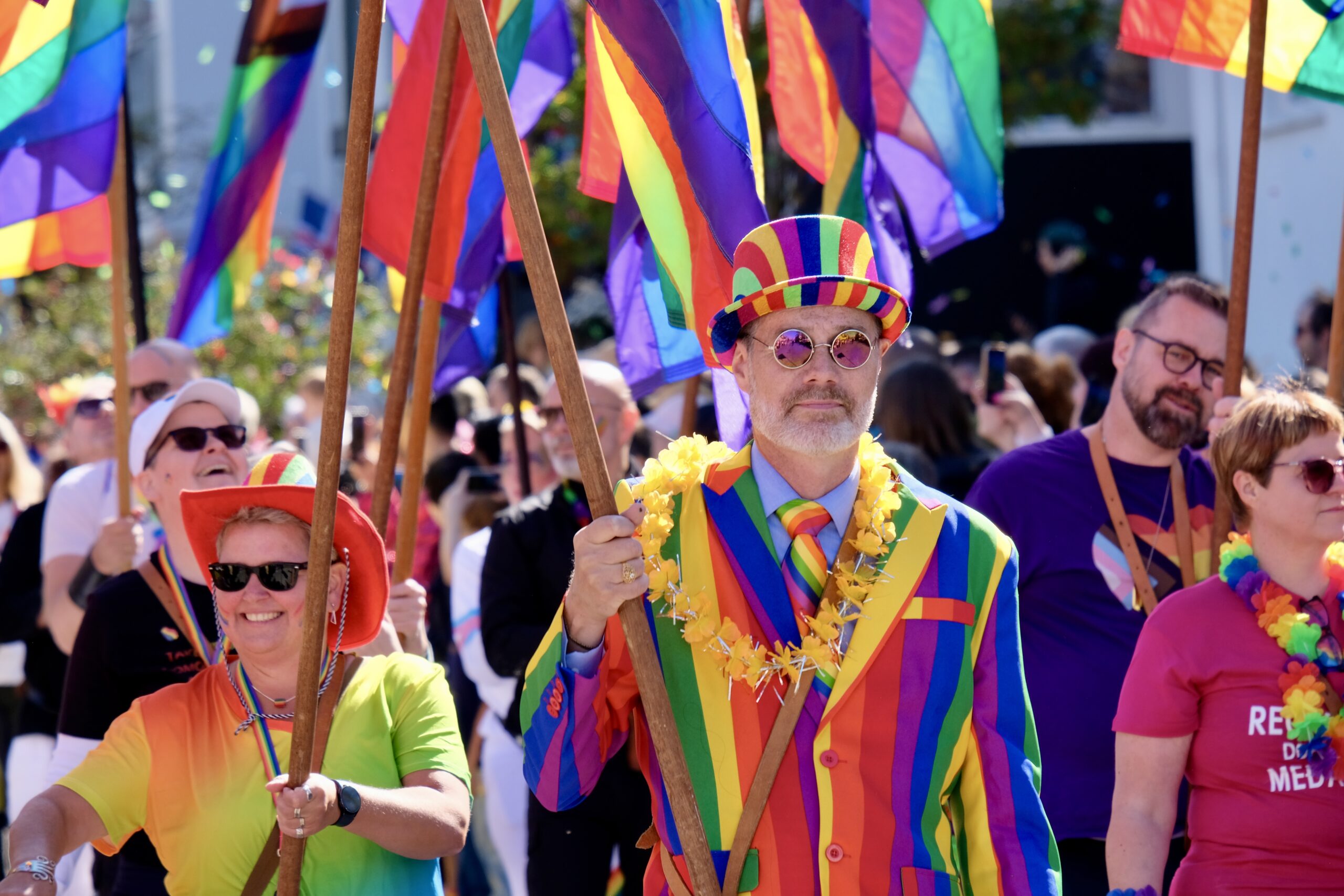
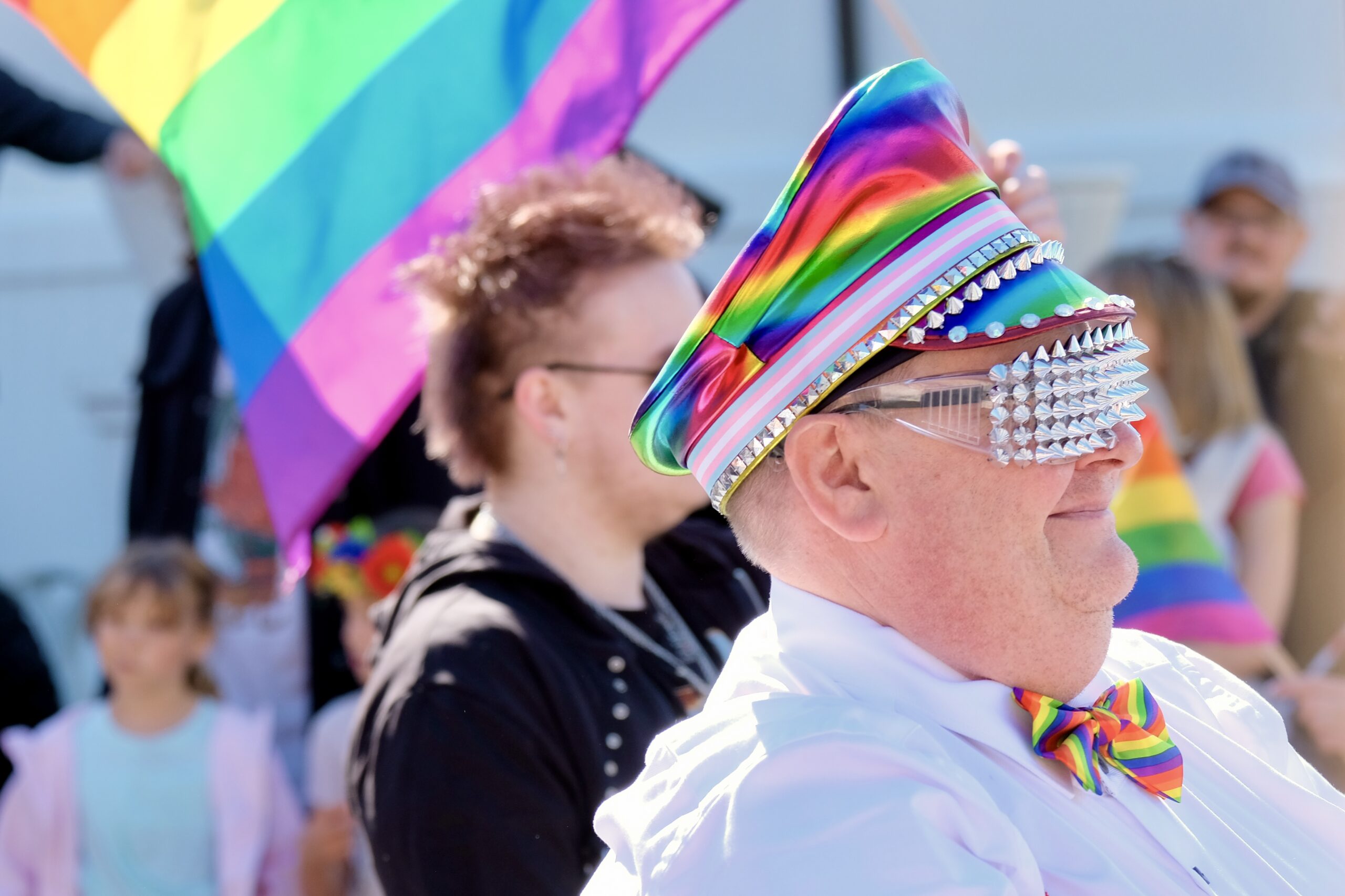
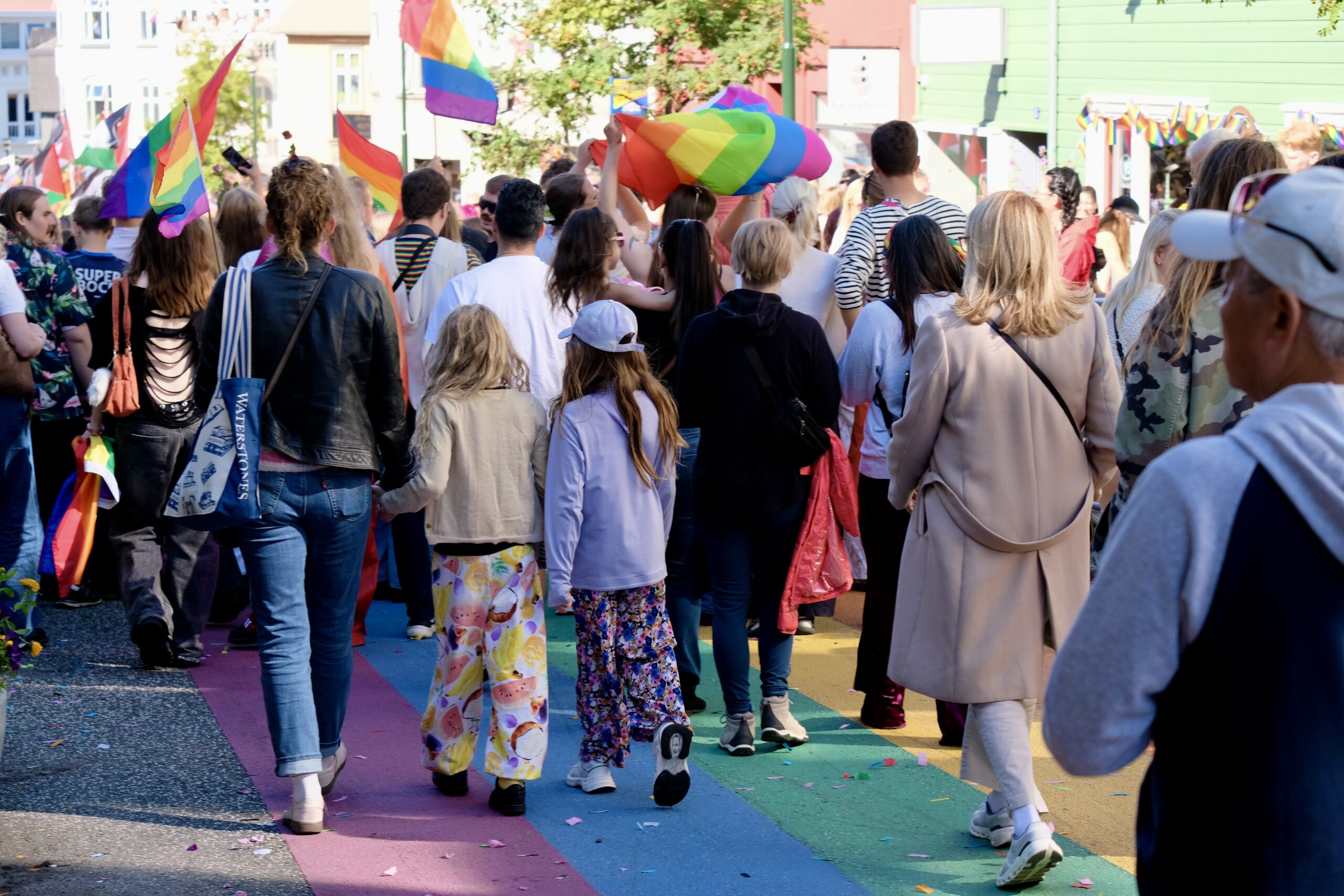
The weather in Reykjavík had been dreary all week, but yesterday in it was nearly perfect for the Pride Parade. Clear blue skies, upper 50s, and a massive celebration of diversity and equality. Perhaps the biggest difference about Pride in Iceland versus the US right now is the fact that the Prime Minister attended and spoke at the celebration.

Noted & Done

  • I’m noticing that the light is starting to change. When I moved here last month it felt like daylight when I went to bed, now it feels like dusk and I’m awake to see an actual sunset.
  • A Highland bus from TREX is bookable for a self-planned trip to Þórsmörk or Landmannalaugar. They aren’t cheap at ~$228 round-trip, but the alternative is to rent a car that can drive through deep rivers. Apparently these buses can handle up to 2 meters of water.
  • Registered for my classes at the University of Iceland.
  • Checked out Góði hirðirinn, a second-hand shop, and got some fun and random things for my apartment.
  • Went to an event billed as a SuperCollider Session at Mengi, which showcased students from the Iceland University of the Arts playing pieces they developed through a music programming course.
  • Finished reading the book The Second Mountain: The Quest for a Moral Life by David Brooks.

Iceland: Week 2

My first week in Iceland had a lot of necessary logistics and administrative tasks, getting settled in my apartment and wrapping my head around living in a new country. But in my second week I was able to start exploring, not just around Reykjavík but more broadly into the countryside and Highlands.

The week began with my mind back in the USA since Emoji had a vet appointment to clean his teeth and extract at least one. My little guy is an old man by dog standards, and because of his heart condition it always makes me nervous when he has to go under anesthesia. The procedure went okay, but when they got a better look during surgery they discovered that many additional teeth needed removal — they extracted 14! Apparently dogs have ~42 total, but given that he’s lost 10 in the past that means he’s down to less than half. He’s doing okay, but every dog owner on the streets of Reykjavík can attest to me missing him as I stop for lengthy conversations with their pups.

My city explorations this week were long exploratory walks, reaching beyond the tourist streets to find myself on industrial corridors and inside abandoned WW2 bunkers. I’ve always liked to see a city this way, through the alleys and backyards. I hiked around Öskjuhlíð, a forested area near the Perlan Museum, walked along the southern coastline penned in by the domestic airport, and stumbled upon unexpected finds like the clubhouse of the Icelandic Radio Amateurs (ÍRA). I hugged the edges of the harbor through the Grandi District, stumbling onto gems like the The Living Art Museum hidden among the fishing trawlers and shopping centers.

But more importantly, I got outside the city. Classes for my graduate program don’t start until August 18, so my goal is to take advantage of my flexible schedule before then to see some parts of Iceland that I’ve never visited before.

On Wednesday I went to the Hveradalir geothermal area in Kerlingarfjöll, a mountain range in the Highlands between the Langjökull and Hofsjökull glaciers. It’s an stunning place, where boiling waters create steam that billows through the muddy hills, mixing with fog to continually obscure and reveal the mix of greens, browns, reds, and snow white of the landscape. I was in Yellowstone earlier this summer, which felt like a geothermal opener to this main act. The hills were steep and muddy, and the slow ascent and decent of other hikers provided a useful sense of scale when looking out over the vast landscape. This was my first time in the Highlands, and I loved it. The road there was as rough as I’d been warned about, probably the worst I’ve experienced outside of Costa Rica, but landscapes were otherworldly.

The view as you enter into the Hveradalir geothermal area in Kerlingarfjöll.
Most of the hiking paths are along these ridges, which are reinforced with wooden planks on the steepest parts, but given the mud I should have brought my hiking poles for stability.
This view came just after descending a portion that was completely fogged in, with maybe 15ft visibility. The weather varied a lot over the hours that I was there.
Snow lingers through late July. Our guide showed me a photo from earlier in the Spring where his van was driving through recently plowed snow that formed a tunnel as tall as his vehicle.

I also went to see the volcanic eruption happening on the Reykjanes Peninsula. Last week the Sundhnúksgígar fissure had its 9th eruption and while it had calmed down a lot there was still a chance of seeing flowing lava. So on Saturday I joined a group heading down the peninsula, and hiked in to a newly established viewing area roughly a mile from the most active crater. There was a hill at the site, completely surrounded by recently cooled lava flows. I couldn’t miss the opportunity to walk across that field to see newly created lava spouting from the closest and highest viewpoint, although now I see that there is official guidance against doing that. 😬

It rained sporadically, which hissed and turned to steam as it filtered through the cooled and blackened crust of the lava’s exterior and hit the molten core. In the shortened distance from the top of the hill I could see with my naked eyes the magma spewing violently from the crater and a river of lava flowing down directly into the field between us. It’s honestly quite humbling to witness the power of the earth like this, a fact that was reinforced on the drive back as we saw where flows from previous eruptions had encroached on the town of Grindavík and destroyed roads and pipelines in the area around the Blue Lagoon.

A closeup video of the eruption, shot through my 50-200mm Fuji lens. Good for capturing, but my binoculars provided the best view.
The lava field from the recent eruption, with the hill I climbed up for a better view.
The edge of the lava flow, which I was told advanced about 20 meters since the day before. If you peered in closely in certain spots you could see the red hot lava underneath. Near the edges it also smelled of burning, likely from the moss it was consuming as it advanced.

Noted & Done

  • Got my pool card, which I can use at any pool in the city of Reykjavík.
  • Saw Victor Shepardson at Nordic House.
  • Saw Tonik Ensemble at Nordic House.
  • Saw Skúli Sverrisson & Óskar Guðjónsson at Mengi.
  • Figured out the laundry situation in my apartment building.
  • Waited to hear back from the Directorate of Immigration about my residency card (I was supposed to get it this week).
  • Finished reading Your Absence Is Darkness, a novel by Jón Kalman Stefánsson. It’s the third book I’ve read by him, and like much of Icelandic literature and movies it’s both beautiful and tragic.
  • Visited the Gullfoss waterfall on the way to the Highlands.
  • Visited the Seltún Geothermal Area on the way to see the volcanic eruption. A very interesting, if short, trail through bubbling pools and steamy ground. Similar in scope to some areas I saw in Yellowstone.

Laurel Highlands Thru-Hike, May 2022

Over the last few years I’d had my eyes opened to the wealth of public lands in Western Pennsylvania, and enjoyed discovering all the various hiking trails. One of my favorites is the Laurel Highlands Hiking Trail, a 70-mile route from Seward to Ohiopyle that winds through State Parks, State Forests, and State Game Lands. The diverse landscapes it connects include imposing rock outcroppings, tangled rhododendron tunnels, and quiet fern-filled forests. When I started a sabbatical a few months ago there were a lot of things I needed a break from — to stop doing — but one of the few concrete goals I had was to complete a thru-hike of the Laurel Highlands.

I’d never done any overnight backpacking, so this trip required a bit of planning, learning, and training to pull off. But last week I successfully completed the 70-mile hike, and really enjoyed myself! Below are some day-by-day notes for my own documentation that might hopefully help others who are interested in planning a similar trip.

The Route

The Laurel Highlands Hiking Trail map has been hanging on my office whiteboard for over a year, where I mark off the sections that Molly and I have completed together. These are 6–8 mile out-and-back hikes, so while we’ve seen a lot of the trail it’s been fairly slow going, and difficult to fill in some of the more remote gaps.

The trail runs from Ohiopyle, PA (mile 0) to Seward, PA (mile 70) and I hiked it in reverse because the segments worked out a bit better for me and it seemed more celebratory to end in a bustling small town full of outfitters and restaurants, rather than a quiet parking lot.

One of the things that made this trip seem doable, as a first-time backpacker, are the eight different shelter areas along the trail. Each one contains a handful of three-sided Adirondack shelters with integrated fireplaces, which can be reserved ahead of time. The shelter areas are well maintained by the PA DCNR, who provide cut firewood, bear-proof trash containers, and clean outhouses.

The spacing and number of shelters allows for a variety of different itineraries, and I decided to do the hike in five nights, starting Monday morning and ending on Saturday afternoon.

Continue reading “Laurel Highlands Thru-Hike, May 2022”

One foot in front of the other

It’s easy to enumerate what the pandemic has taken away from us, but I’m trying to reflect on the positive effects of lockdown too. For one, I’ve never been able to spend so many consecutive nights with Molly and Emoji. When Molly and I first met, we lived in different cities, and even when we moved to Pittsburgh we were both traveling constantly. Spending an entire year together has been a silver lining; I can’t imagine going through this without her. Emoji has been very happy that we’re home all the time, and I don’t miss driving out to the doggie boarding place to drop him on the way to the airport. That fuzzy little guy is the best part of working from home.

Cemetery Walks

In terms of activities, the biggest new thing for me has been building a consistent walking and hiking practice. Every day, when I’m done with work, I go for a walk through my neighborhood. Usually I swing through the Allegheny Cemetery, which has enough wooded areas to attract wildlife. I like to have a consistent route because it helps me see subtle shifts in the changing seasons, and identify how my routine intersects with others. I often see the same people in the graveyard: runners, mourners, and that one guy who brings his guitar to serenade the unkindness of ravens (that’s actually what a group of ravens is called!).

There was one man I saw consistently for months. He would park in the same spot and set up his folding chair near a candle covered gravesite nearby. He was there when I arrived, and stayed until sun set. When I saw that Creative Nonfiction had a tweet-length writing contest I fired up the old Small Flock account to write a micro-story about it:

Forest Hikes

We also started hiking every weekend. I knew I enjoyed hiking, but it always felt like a thing I did infrequently, maybe on a trip, with much planning involved. We started going because it was pandemic friendly, but it was a revelation to realize—wait, we could do this every weekend!

Molly and Emoji on the Heritage Trail in Raccoon Creek State Park

Western Pennsylvania is chock-full of public lands within a 1.5 hour drive of Pittsburgh. National Forests, State Parks, State Game Lands, Wilderness Areas. There are so many options that we’ve never had to hike the same trail twice (unless we wanted to). I love being in the woods, and the landscape here is gorgeous year-round with its rolling hills, massive rock outcroppings, and cozy hemlock groves.

We hiked over 250 miles in the last year, all of them with Emoji on our side—pulling us along as fast as he can. Who knew that such a tiny dog could have the energy to hike up to 12 miles a day? It’s one of his favorite words now; if he hears us say “hiking” he’ll jump up in excitement. It’s definitely one of the things I hope we hold on to as the pandemic fades. It’s good for all of us, physically and mentally, to spend a few hours a week on the trails.

Emoji, in his Stormy Kromer gear